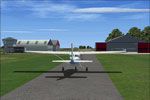
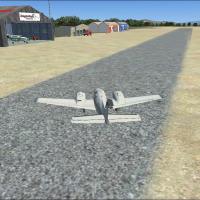
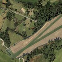
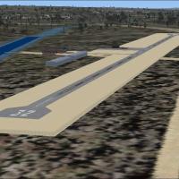
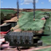
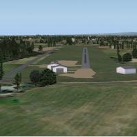
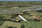
FSX Scenery

Page 147

Sort
Reset
Preview screenshot

Tappahannock Airport

At Tappahannock Airport in Virginia (KXSA), Jon Raines presents a project whose terminal mirrors photos available on the airport’s site. The effort remains preliminary, with a final version expected to add detail, and the author requests access to additional reference photos of Tappahannock Essex County to guide refinements.

Country
United States of America
File Size
125.29 KB
Total Downloads
69
Preview screenshot

EPAR Airport

Paradyz, Poland hosts a fictional airfield designed by Paradyski for light aircraft, offering a compact layout suitable for small planes. Paradyski provides two BGL files, EPAR_ADEX_AW_CVX.bgl and EPAR_ADEX_AW.BGL, tied to the site's geographic placement and basic structural data.

Country
Poland
File Size
106.11 KB
Total Downloads
68
Star Rating
2/5
Screenshots
1
No image available.

Breidden And Camphill

Two grass airstrips feature accurate terrain models, traffic, and a PDF flight plan, with sounds available as a separate download. Camphill lies in the Peak District and Breidden Strip sits 4 miles NNE of Welshpool and 8 miles south of Chirk, by Neil Birch.

Country
United Kingdom
File Size
4.41 MB
Total Downloads
68
No image available.

Narrogin Airport

Narrogin Airport (YNRG) sits in Western Australia’s wheat belt, southeast of Perth, as a small rural strip serving local aviation and the Narrogin gliding club. By Frank Salter, it requires Rwy12 object libraries to function properly.

Country
Australia
File Size
2.96 KB
Total Downloads
68
Preview screenshot

Elbert County-Patz Field

Two folders accompany a field in Elbert County, near Elberton, Georgia, identified by code 27A, with creation credited to Jimmy R. Martin. Screenshots illustrate enhanced terrain and environmental overlays in the surrounding area, highlighting how the locale is depicted.

Country
United States of America
File Size
88.18 KB
Total Downloads
67
Star Rating
1/5
Screenshots
2
Preview screenshot

Newton Airport

Newton airstrip (3N5) lies 3 miles south of Newton, New Jersey, and covers 90 acres as a public field with no transient services or fuel. It relies on satellite imagery for placement and uses ezhousz.zip along with EZ Objects, RWY 12 Objects, OZx Libraries 1.0 to achieve full effect.

Country
United States of America
File Size
6.28 MB
Total Downloads
67
Star Rating
5/5
Screenshots
21
No image available.

Marlboro Airport (2N8)

2N8 Marlboro Airport remains closed since 2002, and the runway is modified to reflect that status while the surrounding area is stripped to reveal satellite imagery, producing a satellite-referenced depiction of the site today clearly.

Country
United States of America
File Size
197.58 KB
Total Downloads
67
Preview screenshot

Riverside Airport

Riverside Airport (4B2) in New York sits between I-90 and the Erie Canal and features a 3500-foot airstrip. A 10,000-foot water strip defines its amphibious capability, and the layout reflects mid-century aviation design, historically noted.

Country
United States of America
File Size
330.81 KB
Total Downloads
67
Screenshots
1
Preview screenshot

Garberville Airport (Update)

Phillip Coyle delivers an ADE-based refinement for Garberville Airport O16, adjusting runway positioning and taxiway widths while expanding parking areas to reflect real-world alignment. Two BGL files, O16_ADE.BGL and O16_ADE_CVX.BGL, accompany the work, and newly placed objects from default libraries add functional detail along the Northern California coast.

Country
United States of America
File Size
296.9 KB
Total Downloads
66
Screenshots
1
Preview screenshot

Lumb In Rossendale

A private airstrip update uses SbuilderX to recreate the surface, enabling 100% coverage. An NDB sits on the field at 200.10, range 6 miles, to aid locating it, and the package includes several bgl files and a barrel.bmp bitmap.

Country
United Kingdom
File Size
139.23 KB
Total Downloads
66
Screenshots
1
Preview screenshot

Big Creek Airport

In Belize, Alf B. Meier presents a Big Creek airstrip add on that serves Savannah and Big Creek communities, with the internal designation MZ63 and an IATA code BGK, coordinates derived from Google Earth, and delivered as .bgl files.

Country
Belize
File Size
112.89 KB
Total Downloads
66
Screenshots
1
Preview screenshot

Nether-Huntleywood Scenery Update

Neil Birch issues NH.ZIP for Nether-Huntleywood in the United Kingdom, designed for Neil's Microlights. It replaces a ground depiction to more accurately reflect the new runway, and requires placing a .bgl into Neil's Microlights folder to apply.

Country
United Kingdom
File Size
10.78 MB
Total Downloads
65
Star Rating
2/5
Preview screenshot

Midlem

Neil Birch creates a compact midland airstrip experience in the Scottish Borders for microlight pilots, positioned about five nautical miles southeast of Galashiels and seven nautical miles north-northeast of Hawick. The project uses a custom ground poly aligned with default ground polygons and adds static objects from North/Midlands and South-West libraries.

Country
United Kingdom
File Size
1.79 MB
Total Downloads
65
Screenshots
3
Preview screenshot

Fictional Airport At Peterhead

By Graham Christie, a fictional airstrip near Peterhead, Scotland, includes two BGL files. It appears on GPS and shows as Peterhead when EGJC is entered, though it does not appear in the airport menu, and the two BGL files are provided for integration.

Country
United Kingdom
File Size
2.71 MB
Total Downloads
65
Preview screenshot

Landing Pad Scenery For NZWK Fix

By Troy Chapman, this self-contained add-on for NZWK at Whakatane replaces previously deleted structures and places a landing pad at NZWK airport only. It includes NZWK_Facilities from the Whakatane file and the Landing Pad item, and positions the object in Timmo's NZWK add-on, potentially misaligned with the default NZWK.

Country
New Zealand
File Size
390.75 KB
Total Downloads
65
Screenshots
1
Preview screenshot

Salton Sea Airport

An informal sailplane facility operates under ID# SSC1 for the Salton Sea Soaring Club, located near Borrego Springs, California. Created by Ken Leamy and Falcon Von Leamy, it includes thermal activity to support glider flights.

Country
United States of America
File Size
477.96 KB
Total Downloads
65
Screenshots
5
Preview screenshot

Manjimup Scenery Update

Uwe Schweitzer creates a Manjimup option compatible with MANJIMUP.ZIP, focused on the town of Manjimup in West Australia. Night lighting effects appear, enhancing the local layout while keeping the reference to that geographic area explicit.

Country
Australia
File Size
2.92 MB
Total Downloads
64
Screenshots
1
Preview screenshot

Peterhead Airport

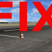
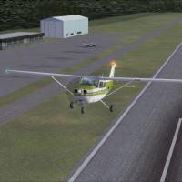
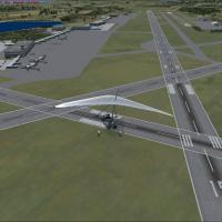
Expanded Peterhead airport option, by Graham Christie, adds a taxiway fix for AI traffic and introduces a longer four-runway variant. It ships four BGL files in the traffic folder along with two additional folders, JET 757 and C130, containing traffic for aircraft you will have to download, and these files work with both versions.

Country
United Kingdom
File Size
1.3 MB
Total Downloads
64
Screenshots
9
Preview screenshot

Baldoon

Gordon Barnes recreates Baldoon airfield as UK09 with a single runway to reflect the layout and its wartime history, including target towing operations and the 1942 addition of two concrete runways. Two files, UK09_ADEX_GB.BGL and UK09_ADEX_GB_CVX.bgl, accompany the package.

Country
United Kingdom
File Size
370.62 KB
Total Downloads
64
Star Rating
1/5
Screenshots
1
Preview screenshot

HE Production Facility

In Maine, about 20 miles from Bangor, the main facility at KHEP sits fifty stories tall and fills more than 8,000,000 cubic feet, allowing aircraft to pass inside. A second airport, KHES, lies about thirty miles south, featuring a single runway, taxiways with lighting, taxiway signs, navigational aids, and tower and ground control.

Country
United States of America
File Size
4.56 MB
Total Downloads
64
Screenshots
11