Page 36
Searches the whole library — filter by sim & category on the results page
KHFD Hartford–Brainard near downtown Hartford, Connecticut gains refined ramp and taxiway alignments that match real-world layouts, with on-site structures positioned for improved realism. A Hartfo…
 United States of America
This Waiheke Island addon, by Robin Corn and Michael Allen-Andrews, is designed for SP1, SP2, and SDK and can pair with an Auckland project while functioning as standalone. It features a custom gra…
 New Zealand
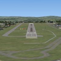
The Plymouth Airport EGHD expansion shifts Runway 13 end east to improve clearance over the road and adds ILS at both ends, while Runway 06/24 remains closed and the main taxiway intersects the exp…
 United Kingdom
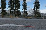
CBW4, tied to a remote airstrip in northwestern British Columbia, transforms the site into a fictional RCMP Ranger Station and campground, crafted by Bob Caparoula. Ranger Outpost and camping areas…
 Canada
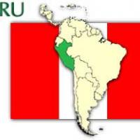
Collique Airport in Peru (SPOL) uses ADE9X v2 based on satellite maps and includes flying birds and other added objects. Credits go to Antoine Calleja for the environment and Jim Dhaenens for the l…
 Peru
Peru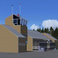
The Port-Menier facility on Anticosti Island in Quebec, bearing code CYPN, sits along Golfe Saint-Laurent, Quebec, Canada. Two original buildings stand amid default objects, and new fencing plus an…
Canada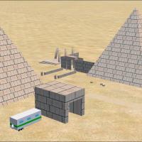
Researchers reveal an unknown ruin in the south-western corner of Egypt, named Ado-Shem, and they speculate the site could lead to the long-lost Giant Pyramid. By Andy Johnston, the narrative prese…
 Egypt
EgyptLG51 lies in a bay off the coast between Ioannis Daskalogiannis Chania Airport and Nikos Kazantzakis Iraklion (Heraklion) Airport, offering a GPS-enabled carrier experience for nearby airfields. Ai…
 Greece
Angel Salazar produces new visuals for the Merida airport for Flymex, reflecting airport branding and layout considerations. Fabian Mena Canche handles the conversion, delivering the updated presen…
 Mexico
Illinois’ Lowry AFB project replaces Chanute AFB as a flight-training field and preserves two hangars for a museum, while including a Flatten file named AFX_KLOW_ALT.bgl that is used to flatten, re…
United States of America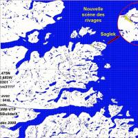
Saglek's airstrip, ICAO CYSV, sits at 279 feet near Saglek, Newfoundland, with runways 35 and 17. ILS 110.00 = YSV GS-DME hdg 341°, VOR/DME 108.05 = YSV, and ADF 251.0 = XAW accompany ATIS 128.15 a…
Canada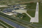
Den Helder Airport (EHKD) receives a detailed upgrade that aligns ground polygons and coastlines with real-world charts, while hangars, maintenance buildings, and a control tower mirror maritime an…
 Netherlands
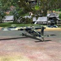
By Gera Godoy Canova, Richu-Pochi in Peru hosts a biweekly cargo flight operated by Brother Ephrom from the Holy Heart Mission Main House in Cuzco to Inchu-Pinchu Village, delivering seeds and tech…
Peru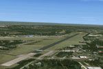
An extension to the NL2000 v4 environment centers on the Soesterberg site (EHSB), delivering custom 3D structures and improved ground surfaces that blend with the NL2000 v4 backdrop. It remains com…
Netherlands
NL2000 v4.01 EHSB Soesterberg Air Base recreates the former Royal Netherlands Air Force site with photoreal ground imagery, precise runway markings, taxi paths, and surrounding areas. The airfield …
Netherlands
Castlegar Airport (CYCG) gains a corrective patch that fixes reversed runway designations, credited to P. Nigel Grant and Vern Opperman. The attached CYCG_ADE_PNG.BGL replaces the existing designat…
Canada
An enhanced rendition of Laconia Municipal Airport (KLCI) in New Hampshire replaces most default buildings and adds aprons, roads, taxiways, and static vehicles, aligning with real-life changes and…
United States of America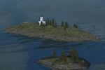
Two lighthouses, Five Fingers Lighthouse and Cape Decision Lighthouse, are replaced within the Tongass Fjords context by this adjustment, which uses nonredistributed components from the base progra…
United States of America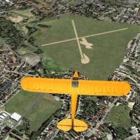
First version documents the Cruz Alta airfield in Rio Grande do Sul, Brazil, SSAK, by Rogerio Picada, with plans to add buildings later. It centers on a BGL file named AFX_SSAK.bgl that represents …
 Brazil
Maturin International Airport (SVMT) in Maturin, Venezeula gains taxiway designators and cargo and military parking, and the surrounding area is redone, with the effort credited to Shanard Letang; …
 Venezuela (Bolivarian Republic of)