Page 42
Searches the whole library — filter by sim & category on the results page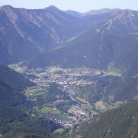
Two heliports and one small runway gain a place in a photoreal depiction of Andorra, located in the Pyrenees. Andy Aundrias delivers this work, with the file name ANDORAV21UP.ZIP, and highlights th…
 Andorra
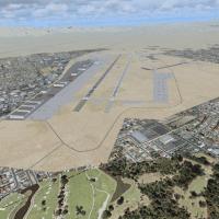
Nellis AFB (KLSV) in Nevada gains ramp parking for military aircraft and added objects, while a sloped flatten erases the mesa effect where the base meets desert terrain. A 10 M terrain mesh for th…
 United States of America
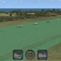
Seventeen Dutch airports, including EHAL and EHBD, gain parking facilities and taxiways, while Traffic Tools generates a flight plan and AI aircraft for these airports. Most are forgotten by Micros…
 Netherlands
David Sheridan delivers a photoreal depiction covering Perth, Frematle, Jandakot and surrounding areas in Australia, with high to medium detail and no autogen. It remains freeware, permits uploadin…
 Australia
Michael Mannschreck maps a broad area in Southern California, spanning from Los Angeles to San Diego and Riverside, with extensions into Palm Springs and parts of Arizona, plus a feature named Bug …
United States of America
VOBL in Bengaluru, India, opens to commercial traffic on 23/05/2008, replacing the closed HAL Bangalore Airport (VOBG). NAVAID data list ILS for Runway 9 IBAN 109.3 and Runway 27 IDEV 108.3, plus V…
 India
India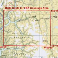
Multi-LOD 38-m mesh and the local landclass, water class, and seasons files cover the Bella Coola area (N51*45'-52*40' W125*35'-127*25'), with accurate placements of lakes, rivers, roads, and strea…
 Canada
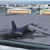
A Griffiss AFB installation in New York from the late 1980s features native objects by Jim Dhaenens, using GMAX and the SP-2/Acceleration SDK, including lighting elements such as roundspot, 4litesq…
United States of America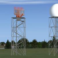
Located at the Italian air base code LIPA, this project uses ADE9X with Google satellite imagery and adds objects to represent hangars, shelters and radar installations. Hangars, shelters, radars a…
 Italy
Italy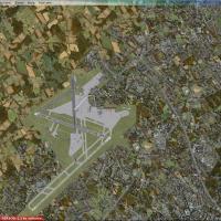
Dublin's 2010 layout places Pier A through D with the West Apron and notes F-INN without a T2 area. Overspill parking expands and the cargo area extends, while Gate 36 enlarges to accommodate Aer L…
 Ireland
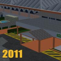
An airfield south of Georgetown, Guyana, appears as version 1.0 and presents an accurate taxiway and apron layout, a custom designed terminal building, and runway end markings, with creator attribu…
 Guyana
Gates align with current airlines and cargo ramps at KBNA in Tennessee, and jetways remain visible and can be called to the jet by CNTRL-J. Made using ADE, by Rob Touchtone, it works with WoAI or a…
United States of America
Operators at Corpus Christi, Texas, host two primary-flight squadrons, VT-27 and VT-28, flying the T-34 Mentor, alongside VT-31 and VT-35 for intermediate training with the T-44 Pegasus or UC-12 Hu…
United States of AmericaBy Brian C. Selb, this Southern California enhancement, version 2.0 (CA), aggregates updates across KMHV Mojave Airport, KTSP Tehachapi Municipal Airport, KVBG Vandenberg AFB, Palm Springs Windmill…
United States of America
This base centers on the German Eurofighter and features over 150 objects spanning varied forest, roads, and airport streets. The assets originate with afs-design.de, authored by A.Meyer, and a ref…
 Germany
Version 1.01 replaces the original trees and vegetation to fix SP-2 transparency issues, and uses a 1 meter per pixel resample across the KNZY footprint precisely. KNZY parking layout is defined pr…
United States of America
In KMCI, gate assignments link each gate to a specific airline, and several default jetways cover all gates. Patrick Finch implements the Star Runway technique to activate crosswind runways at KMCI…
United States of America
Moraitis Vaggelis presents a standalone LGAV edition for the Athens-area airport in Greece, labeled saoxt_LGAV.V2, representing version 2. In this second attempt, almost all buildings and hangars a…
 Greece
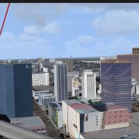
In California, the layout adds buildings for the downtown district, Balboa Park, and Little Italy, reflecting distinct urban cores of San Diego. By Brian N. Winton, it undergoes testing with KSAN t…
United States of America
An v0.9 base version adds four airfields including Ham Tan, Cheo Reo, Quang Ngai, Nui Dat-Luscombe field (RAAF), and three helicopter refueling spots spread across key locations, while a photoreal …
 Global (World)