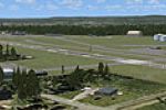
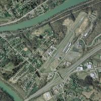
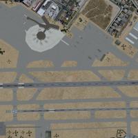
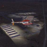
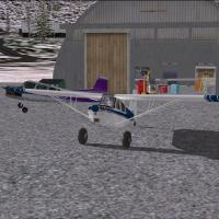
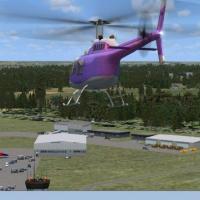
United States of America

Page 42

Sort
Reset
Preview screenshot

Moriarty Sailplane Airport

This FSX scenery add-on for the United States index depicts Moriarty Sailplane Airport (0E0) in New Mexico’s high-desert plain, presenting photoreal ground textures from USGS imagery, precise runway markings, glider staging zones and club hangars; the lightweight BGL build maintains smooth frame rates and aligns seamlessly with Herman Lamb’s optional member-hangar set.

File Size
1.85 MB
Total Downloads
179
No image available.

Youngstown-Warren Regional Airport

Anchored in Ohio’s Mahoning Valley, this FSX-only revamp of KYNG Youngstown–Warren Regional Airport supplies correct Allegiant Air stand allocations, functional animated jetways (Ctrl-J ready), realistic taxiway geometry and refreshed parking codes, giving domestic-regional flyers an up-to-date Midwest hub for IFR and VFR circuit work; a refined AFCAD sharpens AI pathing for scheduled service realism.

File Size
94.9 KB
Total Downloads
178
No image available.

Hayden/Yampa Valley Airport

Hayden–Yampa Valley Airport (KHDN) for FSX gains a practical overhaul with this AFCAD rework: additional terminal gates, widened concrete apron, revised parking designations and optimized taxi link geometry produced in Airport Design Editor X9, all aimed at ensuring believable airline AI movements and more accurate ground handling within Colorado’s high-country hub.

File Size
6.47 KB
Total Downloads
178
No image available.

Watertown International Airport

Watertown International Airport (KART) for Microsoft Flight Simulator X refreshes this upstate New York airfield with revised apron layouts, corrected taxiway geometry, extra GA and commuter gates flagged for Cape Air, larger paved and gravel parking areas, static ground vehicles and lighting; positioning aligns with AirNav charts and satellite imagery along Lake Ontario, all built from default library assets.

File Size
8.77 KB
Total Downloads
178
Preview screenshot

Northampton Massachusetts

Built for Microsoft Flight Simulator X, this FSX scenery download renders Northampton, Massachusetts airfield 7B2 and its Connecticut River valley surroundings with custom library objects, matched to Flight1 Ultimate Terrain USA for geo-accurate VFR flying; updated apron markings, small hangars and GA ramps aid short-field practice and New England cross-country navigation.

File Size
11.65 MB
Total Downloads
178
Star Rating
5/5
Screenshots
20
Preview screenshot

Hawes AOF

Built on the abandoned WWII Hawes Aux #1 strip east of Edwards AFB, this FSX flight-sim scenery revives the Mojave outpost as Nevada Systems’ UAV hub, blending photoreal desert textures, custom Acceleration-SDK objects and soaring-friendly thermals—useful for glider testing, pattern drills or light tactical sorties from the former Victorville satellite field.

File Size
6.16 MB
Total Downloads
177
Screenshots
4
No image available.

Amarillo International Under Construction

Amarillo International Airport KAMA for FSX depicts the ongoing terminal renovation, features reserved Southwest Airlines parking at gates 31–33, integrates the two Bell Helicopter V-22 Osprey pads, and updates ground polygons, gate links, and night textures, offering Texas Panhandle sim pilots a current, technically accurate airfield layout.

File Size
13.33 KB
Total Downloads
177
Preview screenshot

Nashua Airport

Boire Field (KASH) in Nashua, New Hampshire, United States gains a refreshed AFCAD in this FSX-specific package, replacing default autogen with geo-referenced structures created in ADE9X, adjusting taxiway width to 50 ft, and adding static GA aircraft, apron vehicles and accurate ramp markings for more plausible circuit practice.

File Size
1.08 MB
Total Downloads
176
Star Rating
3/5
Screenshots
1
Preview screenshot

Ryan Field

This FSX scenery add-on upgrades Ryan Field (KRYN), accurately positioning the Tucson general-aviation aerodrome with revised taxiway geometry, custom hangars, desert photoreal ground polys, local objects, default autogen, and AI pattern support, delivering steady frame rates for VFR training hops and circuit work across southern Arizona.

File Size
113.16 KB
Total Downloads
176
Star Rating
1/5
Screenshots
2
Preview screenshot

York Airport

York Airport (KTHV) for FSX refreshes this Pennsylvania general-aviation field with revised apron geometry, realigned taxiways, detailed service roads, replacement terminal and hangar models, plus static vehicles, light poles and nearby residential as well as industrial structures, all matched to AirNav data and satellite imagery while retaining pure stock-library compatibility for straightforward integration.

File Size
9.44 KB
Total Downloads
176
No image available.

McCarran Int'l Airport

Sim pilots operating within the United States will find this FSX AFCAD for KLAS—Harry Reid International, Las Vegas—reworks gate coding, cargo stands, jetway alignment and service-road topology, easing taxiway flow while preserving SID/STAR compatibility for dense AI traffic and VATSIM or PilotEdge operations; the tower viewpoint is repositioned for unobstructed runway surveillance, refining situational awareness.

File Size
28.07 KB
Total Downloads
175
Preview screenshot

Ghost Airports PA Scenery Update 2

Pennsylvania’s Ghost Airports Collection gains Update 2, inserting the long-forgotten Conway aerodrome (identifier PN51) into Microsoft Flight Simulator X via refreshed .BGL scenery, updated screenshots, and documentation, thereby completing the 1940 Cleveland Sectional roster of legacy U.S. airfields for sim pilots pursuing period-accurate VFR navigation across the Commonwealth.

File Size
16.1 MB
Total Downloads
174
Screenshots
1
Preview screenshot

Norwood Memorial Airpord

This Microsoft Flight Simulator X scenery add-on revisits Norwood Memorial Airport KOWD, Boston’s southwestern GA reliever, swapping default autogen for geo-referenced structures, corrected runway 17/35 and taxiway geometry, a new hangar library, dynamic apron lighting and optional static aircraft, offering New England flyers a precise VFR waypoint and realistic IFR practice field without heavy frame-rate cost.

File Size
109.64 KB
Total Downloads
173
Star Rating
4/5
Screenshots
2
Preview screenshot

Yuba County Airport

Covering Northern California’s KMYV and nearby KOVE, this FSX scenery download refreshes runway markings, taxiway lighting, custom AFCAD files and seasonal photoreal ground polygons, adds the Oroville Dam landmark plus the adjacent 18-hole golf course, integrates EZ-Scenery object libraries and tailored AI flightplans for realistic GA circuits across the Sacramento Valley.

File Size
9.77 MB
Total Downloads
173
Star Rating
2/5
Screenshots
14
Preview screenshot

KEWB

KEWB New Bedford Regional AFCAD refresh introduces accurate Cape Air stands, expanded GA spots, revised hangar footprints, a custom-textured water tower, mapped service roads, vehicle parking and a fire station, complete with fuel truck routing; tuned for FSX ground layouts and tested alongside UTX and World of AI packages.

File Size
129.43 KB
Total Downloads
172
Preview screenshot

Goddard Seadrome Seaplane Base

Florida’s Goddard Seadrome Seaplane Base (FD46) brings Frostproof’s private water strip to Microsoft Flight Simulator X, adding timber docks, refined shoreline polys, and nav-aids—NDB 277 kHz and VOR 108.20 MHz—laid out with ADE 1.50. Useful for floatplane and bush flyers seeking accurate coordinates, 78 ft MSL elevation, and updated AFCAD data.

File Size
1.95 MB
Total Downloads
172
Star Rating
3/5
Screenshots
1
Preview screenshot

Bellefonte Airport

Pilots routing through central Pennsylvania will find this FSX rendition of Bellefonte Airport (N96) useful; the add-on supplies a 3,600-ft paved strip at 1,080 ft MSL, updated taxiway layout, custom EZ/RWY12 hangars, ramp lighting, static GA inventory, AI Sky Seeker ultralight traffic, and region-matched terrain for smooth VFR approaches.

File Size
1.69 MB
Total Downloads
172
Star Rating
1/5
Screenshots
2
Preview screenshot

Nutmeg Cabin

Set in Colorado’s Dillon Lake basin, Nutmeg Cabin places a fictive mountain lodge and 2,500-ft dirt airstrip (KARO) amid dense conifer stands, photoreal ground polys, and animated crows and gulls; compiled with AFX, SBuilderX, and RWY12 macros to suit FSX and represent Summit County terrain precisely.

File Size
3.69 MB
Total Downloads
171
Screenshots
1
Preview screenshot

Tonopah Air Show

FSX Tonopah Air Show populates Nevada’s KTPH with static fighters, classic warbirds, aerobatic props and a lone “daredevil” parked near Runway 33, creating a compact air-display environment for desert flying. Crafted from native FSX library assets, the scenery slots neatly into Great Basin cross-country routes for GA or tactical jet operations.

File Size
440.04 KB
Total Downloads
170
Screenshots
3
No image available.

Norfolk International Airport

Norfolk International Airport KORF for Microsoft Flight Simulator X gains a pragmatic overhaul; the primary asphalt runway now spans 10,000 ft for wide-body operations, supplemental cargo hangars dot the apron, and refined AFCAD data sharpens taxiway linkage, ground traffic flow, and AI behavior at this coastal Virginia hub.

File Size
14.82 KB
Total Downloads
169