Page 60
Searches the whole library — filter by sim & category on the results page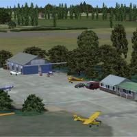
Alf Denham delivers updates for three UK airfields in Volume 19, including Blackbushe EGLK, Bourn EGSN, and North Coates EG0E (not EGOE). The work relies on aerial imagery and guiding references to…
 United Kingdom
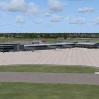
An add-on for KPNS in Florida lengthens runways, reshapes taxiways, and adds a localizer for runway 26 with nearby landclass updates. Art Poole authors the project, and it includes a library of new…
 United States of America
At Florida's KTPA in the Tampa region, airline-specific gates map to real operator placements and cargo ramps reflect current logistics, by Rob Touchtone. Jetways are fully active and controllable …
United States of America
Nordholz v1 places the installation at Nordholz in Lower Saxony, home to Marinefliegergeschwader 3 Graf Zeppelin with IACO code ETMN. The archive ETMN_Nordholz-AB_V1.zip contains two bgl files and …
 Germany
By Kelan Reilly, Steamboat X Mega Pack v2 charts the Yampa Vally Regional Airport in Hayden, Colorado, and the surrounding Steamboat Springs area, including the KHDN terminal built from scratch. It…
United States of America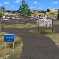
An add-on for Napier Airport in the Hawkes Bay region of New Zealand, this freeware project credits Godfrey Tier for custom buildings and a Godwit statue, with Lawrie Roache handling object placeme…
 New Zealand
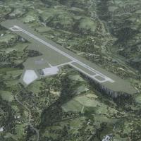
Branson Airport near Branson, Missouri (KBBG) opens in May 2009 as a privately developed commercial facility. It uses ICAO BBG and IATA BKG, bears Version 1.00 by Carlyle Sharpe, and relies on modi…
United States of America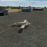
CYFB Iqualuit presents an upgraded apron and parking area, capable of welcoming all aircraft types and up to the B737 series. A single .bgl file accompanies it, and airport information along with c…
 Canada
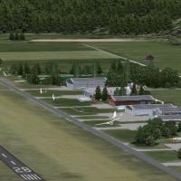
Koenigsdorf-Wiesen, located in upper Bavaria between Munich and the Alps, stands as the focus of a flight-simulation addition, featuring Glider Objects by Wolfgang Piper and a rotating Windsock fro…
Germany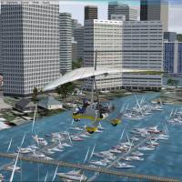
Orion Lyau presents a harbor enhancement for Honolulu, Hawaii, adding boats, docks, and birds to the area around the Yacht Club. The work centers on the file honolulu yatch harbor.bgl, credited to …
United States of America
Located at Lunéville, France, LFQC presents photoreal ground with seasonal variants and a city-wide landclass redraw that highlights the castle and surrounding buildings. The work shows 47 custom m…
 France
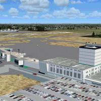
Jackson, Mississippi’s KJAN facility features a custom terminal and a dedicated C-17 hangar for the Mississippi ANG, plus air cargo areas and a central fuel-truck route. The installation relies on …
United States of America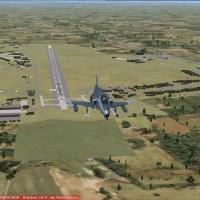
Located in southern Germany near Landsberg (ETSL), Lechfeld AB v1 anchors an active Luftwaffe base with a clear operational role. It houses Jagdbombergeschwader 32, which operates the Tornado ECR, …
Germany
Chuck Bosn presents an OZx companion for the canyon region, placing a resort outside KGCN along the rim and adding hikers, campers, and river scenes. The file AZ GrandCanyon.bgl relies on default l…
United States of America
Kai P. Kamjunke, in collaboration with Alpha-India Group, develops Seychelles Landclass CVX, replacing the default landclass with dedicated BGLs and adding roads around Mahé and Praslin, plus objec…
 Seychelles
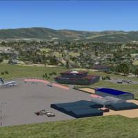
By Jacques Botha and Frits Beyer, Kigali in Rwanda (HRYR) is presented with custom designed buildings and libraries, and features a green and white hangar opened by tuning 115.00 on nav 2. The HRYR…
 Rwanda
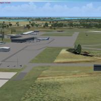
With code MYGF, the Bahamas gateway installation implements ILS on both runways today on site. It adds moving ground vehicles and stationary aircraft to reflect airport activity without altering th…
 Bahamas
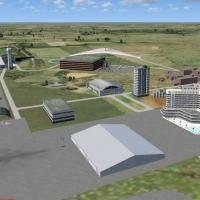
The WMKJ facility in Malaysia receives a 2011 upgrade featuring a new terminal with jetways and a cargo terminal. From the default WMKJ airport, the project adds hotels, a hospital, parking areas, …
 Malaysia
The set uses Airport Design Editor, Google Earth, and EZ-Scenery to model KCRQ McClellan Palomar Airport with parking for United Express and a faithful real-world layout, alongside KOKB Oceanside M…
United States of America
In Provence, LFNH-Carpentras, an airport between Avignon and Mt. Ventoux, features a concrete runway and a grass strip used for gliders. A glider school named VELIVOLE operates there, and the annua…
France