Page 119
Searches the whole library — filter by sim & category on the results page
In Minas Gerais, Brazil, Vazante Aerodrome (SNVA) fills a missing airfield in the default layout. Jose Maia handles authorship, and the GIF vazantex.gif accompanies the listing, which confirms SNVA…
 Brazil
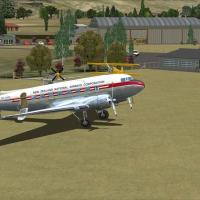
Mandeville, near Gore in New Zealand's Southland, sits with Croydon Aviation Heritage Trust and Croydon Aircraft Company Ltd, which specialize in De Havilland aircraft. This freeware project is for…
 New Zealand
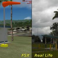
Bocono Airport (SVBK) in Venezuela sits at 5085 feet, the highest airfield in the country, and supports VFR flights with a very dangerous approach. It includes a terminal building, control tower, h…
 Venezuela (Bolivarian Republic of)
Two BGL files, KSBP_ADE.BGL and KSBP_ADE_CVX.BGL, anchor an add-on for San Luis Obispo's airport (KSBP) created by Phillip Coyle. Airport Design Editor compiles the files, and default library objec…
 United States of America
Jervis Bay, designated YJBY near Nowra in Australia, gains taxiways, aprons, parking bays and helipads plus updated runway attributes to reflect real operations. Compatibility with the Royal_Austra…
 Australia
The berkeley marina v2.bgl file adds boats, docks including sea plane docks and a fuel station, and birds to the Berkeley area, by Orion Lyau. Visibility depends on autogen density set to Sparse, a…
United States of America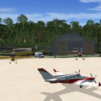
Two image references accompany a work by Jimmy R. Martin for Mores Island in the Bahamas, with files labeled fsx1.jpg and fsx2_large.jpg. Located in Philadelphia, Mississippi, the work emphasizes a…
 Bahamas
Registration 24FA identifies a private-use seaplane facility two miles west of Oklawaha, Florida, spanning 6,000 acres and rising 56 feet above mean sea level. Coordinates are N29°2.07', W81°57.04'…
United States of America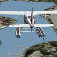
By Steven Supry, this water landing area sits in Hawaii near Honolulu Intl and includes a single helipad, buoys that mark the landing zone, and a seaplane dock. The freeware designation appears wit…
United States of America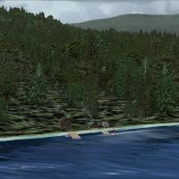
Near Salt Spring Island in British Columbia, Canada, Nathan Bonyun presents a small remote cabin that relies on default visuals. The bgl file sits in the cozycabin subfolder, with coordinates LAT N…
 Canada
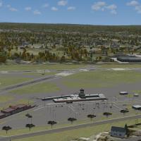
Erie International’s KERI 2012 runway extension revision resolves issues after the KERI_RUNWAY_EXTENSION_UPDATE_2.ZIP, relocating traffic from the old approach end of runway 24 for users of certain…
United States of America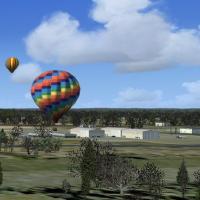
KMPE in Mississippi gains a simple enhancement by Jimmy R. Martin, centered on Philadelphia, Mississippi, with two variants. Images accompany the page, including balloons over the area to reinforce…
United States of America
By Dean Kenyon, the airfield at CYOS in Ontario gains an updated presentation for regional use. Sidney Schwartz supplies two libraries, large_hangars_ss_v2p.zip and ez-terminals_ss_p.zip, for compa…
Canada
KELM in New York state gains an updated layout with improved aprons, taxiways, and roads to align with the real field, plus a new terminal featuring jetways and a more realistic control tower. Two …
United States of America
Free enhancement by Cesar Marinho Costa improves details at Major Brigadeiro Trompowsky Airport (SBVG) in Varginha, Brazil. The author, based in Rio de Janeiro, is credited and June 2007 marks the …
Brazil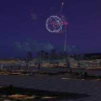
Gilles Ménard provides a single fireworks effect for the sim, packaged as a Firework_st_jean.bgl. It uses assets from the effects folder and targets two Quebec locations, the St-Helene island near …
Canada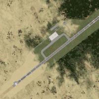
At Owerri, Nigeria, DNIM (IATA QOW) replaces the default DN52 layout with three BGL files: DNIM_ADEX_CJT.BGL, DNIM_ADEX_CJT_CVX.BGL, and DN52_DEFAULTREMOVE.BGL, while an EditVoicePack X modificatio…
 Nigeria
Qamdo Bangda Airport, coded BPX/ZUBD and located in Bangda, Qamdo, Tibet, sits at 4,334 metres, the highest elevation for any airport. Runway 14/32 extends 5,500 metres, the longest publicly used s…
 China
China
Jimmy R. Martin authors KCUT at Custer County Airport in South Dakota, which includes 101 objects, zero POIs, and adds fencing, lighting, and a resort with cattle and horses. Version 2.0, build 14,…
United States of AmericaRobben Island in South Africa presents a dirt runway that allows landings and a small harbor, with the prison positioned at its real-world site. By Frits Beyer, the harbor and prison align with rea…
 South Africa