
The initial addition for Nauru X arrives as NAURU_X.ZIP, increasing the count of people, cars and animals. Access routes culminate at Nauru Intl, where the region becomes visible after loading and …
 Nauru
Nauru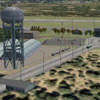
Cristobal Laje creates Almonacid airfield in La Rioja, Argentina (SANL) using default objects for the Acceleration expansion and does not test it with other versions today. The SANL_charts file con…
 Argentina
York's airfield receives aprons, roads, and taxiways, while most default buildings are replaced with new structures and static vehicles populate the area. Two files named KTHV_AFX_JC.bgl and KTHV_J…
 United States of America
Five western Australia airfields appear here, including YSEN Serpentine Sport Aircraft Builders Club, YBUN Bunbury, YCOI Collie, YDEK Demark, and YBLN Busselton, with Bunbury and Busselton showing …
 Australia
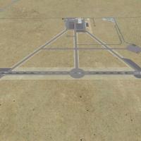
Hawes Aerial Operations Facility reimagines an abandoned WWII auxiliary airstrip east of Edwards AFB in the Mojave Desert as a UAV base operated by Nevada Systems. It traces Hawes AAF Aux #1 herita…
United States of America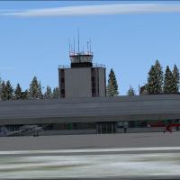
Nashua's KASH airport in New Hampshire gains an ADE9x-based add-on by Tyler Lawrence, with the KASH_TL folder guiding revised structures from Google Earth and Bing maps. It replaces most buildings …
United States of America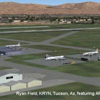
John B. Loney, Jr. provides a compatibility revision for Ryan Field at KRYN, near Tucson, Arizona, based on the original KRYN_V1.ZIP layout. A subsequent file facilitates operation with a newer pla…
United States of America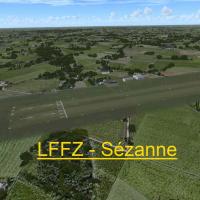
Version 1.0 updates the LFFZ airfield near Sezanne in the Marne department of Champagne-Ardenne, France. Created with ADE, SbuilderX, and Whisplacer by Stéphane Gouzon, the work runs as freeware an…
 France
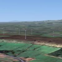
Eight wind generators stand around the town of Blackburn, Lancashire, UK, by Neil Birch. The arrangement serves users of Neil's Microlight's and locates the turbines in and around Blackburn, Lancas…
 United Kingdom
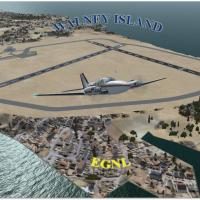
BAE Systems owns a UK airfield and operates private communication flights across the United Kingdom. Three runways form a triangular layout, visible from 140 miles above sea level, while two BGL fi…
United Kingdom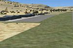
Springbok Airport, registered FASB, lies in the Northern Cape of South Africa as a general-aviation field bordered by semi-desert and featuring custom designed buildings. Jacques Botha is the creat…
 South Africa
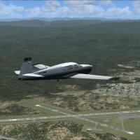
Arcata, California, hosts KACV in Arcata/Eureka and updates taxiways, runways, and parking to real-world coordinates via Google Earth. Airport Design Editor guides two BGL files named KACV_ADE.BGL …
United States of AmericaSivrihisar Airport in Turkey carries IATA code AB and ICAO designation LTAV, situating the airfield within Turkish aviation identifiers and signaling its formal recognition under both systems, whil…
 Turkey
German Schonebeck-Zackmunde airfield (EDOZ) receives an add-on that corrects taxiways and aprons and adds objects for the glider field. It centers on the ICAO code EDOZ, anchoring the upgrade to th…
 Germany
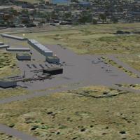
Williston, North Dakota, centers the entry known as KISN, ND, a layout by Jimmy R Martin that remains compatible with Ultimate Terrain USA terrain mesh, reflecting a regional focus and creator-led …
United States of America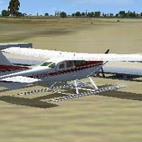
An addition to a private seaplane base in Frostproof, Florida, identified as FD46, uses ADE 1.50 and features docks along with ADF and VOR frequencies. Coordinates N27°45.32', W81°30.84', elevation…
United States of America
Conway airport receives the PN51 identifier in the Pennsylvania ghost-airport roster, added via two .BGL files authored by Richard O. Finley. The original GHOST_AIRPORT_COLLECTION_PENNSYLVANIA.ZIP …
United States of America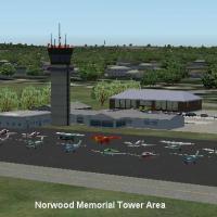
John B. Loney, Jr. renews a Norwood Memorial Airport (KOWD) project, extending a year-and-a-half-old design for use with a newer simulator, and requires the original kowd_v1.zip as a base. The modi…
United States of AmericaKHFD Hartford–Brainard near downtown Hartford, Connecticut gains refined ramp and taxiway alignments that match real-world layouts, with on-site structures positioned for improved realism. A Hartfo…
United States of America
Located in the Bahamas, MYGW West End operates as a cargo facility and features the island’s longest runway, enabling the largest aircraft to operate on a single airstrip, a capability credited to …
 Bahamas