Page 37
Searches the whole library — filter by sim & category on the results page
Two variants, AGEXCL3X.ZIP and AGEXCL5X.ZIP, remove trees near runways for every airport supplied as standard, clearing 3x or 5x runway width. Both extend 1.5x along the runway length, and two arch…
 Global (World)
An add-on around Adi Sutjipto near Yogyakarta, Indonesia, is released as version 1 featuring very dense autogen and carries the WARJ designation. It relies on two files, adisutjipto and warj_alt.bg…
 Indonesia
Version 1.0 for the Duesseldorf EDDL area, credited to Max Epperlein and Thomas Ruth, references TOMEDDL1.ZIP and TOMEDDL2.ZIP as identifiers. It corrects the 05L/23R heading, aligns taxiways to an…
 Germany
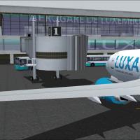
Luxembourg Findel airport entry marks version 1, detailing the addition of new terminal A and B along with the Luxair Cargocenter, while preserving the old terminal and cargo facilities. It centers…
 Luxembourg
CYQB-based Quebec Jean Lesage International Airport, Canada, appears in v3.0 with a Navcanada installation that includes the control tower. It provides lighting on aprons 1 and 2 and installs anten…
 Canada
KBOS in Massachusetts receives a total makeover implemented with ADE v1.37, replacing the default layout. Two BGL files, KBOS_ADE_RS.BGL and KBOS_ADE_CW_RS.BGL, present variants with and without cr…
 United States of America
A set of imagery for autogen buildings is resized from 1024x1024 to 512x512, cutting the size of each file from 683kb to 171kb and reducing loading times to boost FPS. Mip-maps are included and the…
Global (World)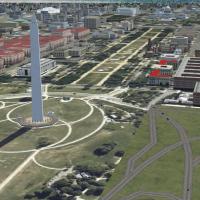
WashDCX 1.0 expands Washington, D.C. models and buildings and adds satellite imagery around the National Mall, along with trees and increased traffic. CVX_WashDCX.BGL, WashDCX.BGL, WashDCX-EXT.BGL,…
United States of AmericaHermann Kuhne enhances 73 airfields across South Africa by using imagery as a template and recreating layouts with Airport Design Editor, producing a set of .bgl files that improve the flying exper…
 South Africa
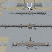
Denver International Airport (KDEN) in Colorado gains six activated crosswind runways, expanded Concourse B with a commuter terminal for United Express, and added fuel trucks to speed servicing, wh…
United States of America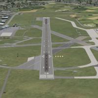
Version 2 for Aberdeen Dyce EGPD extends the main runway to 1949 meters and adds a new link taxiway. Four EGPD_ADEX files are provided to support this configuration, anchoring to the EGPD designati…
 United Kingdom
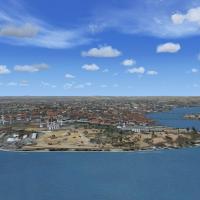
Corrections adjust coastlines along the eastern Marmara region, the Bosphorus, and the Black Sea north of the strait to improve Istanbul’s shoreline representation, addressing a mismatch between me…
 Turkey
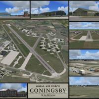
Created by Ian McCartney, it depicts RAF Coningsby in Lincolnshire as of 12 June 2010, with nearly all airfield buildings modelled and rendered on photoreal surfaces. It optimises frame rates for o…
United Kingdom
Geography spans Karamea in the north to Neils Beach at Jackson Bay in the south, with Westport, Greymouth, and Hokitika airports and airfields at Karamea, Franz Joseph, Fox Glacier, Haast, and Neil…
 New Zealand
Ray Smith refines LFPO near Paris with ADE version 1.37, rebuilding taxiways and reconfiguring ground services including terminal parking for diverse aircraft. Two BGLs govern crosswind runway use,…
 France
Raimondo Taburet delivers an Africa-focused SRTM 3, version 2 mesh that spans the continent, providing Africa-wide terrain data. Three files: SRT2AFR.ZIP, SRT2AFR2.ZIP, and SRT2AFR3.ZIP constitute …
Global (World)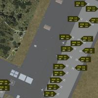
Bagram AFB v3 reworks airfield at Bagram, Afghanistan, updating parking with 2 cargo, 11 military cargo, 21 military combat (eight coded for A10s), and 65 helicopter landing spots; the package adds…
 Afghanistan
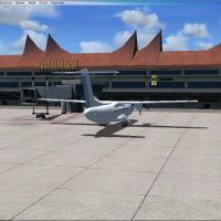
Creator Hadi Tahir presents Minangkabau International Airport as a representation bearing IATA PDG and ICAO WIPT designations, located in Ketaping, 23 km northwest of Padang on Sumatra. It uses Air…
Indonesia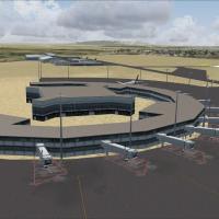
A complete rework of Jomo Kenyatta International Airport (HKJK) in Kenya adds airport buildings and objects, uses FSX stock elements, and increases ramp cargo activity along with extra parking slot…
 Kenya
Kenya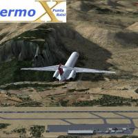
Palermo Punta Raisi Airport in Italy, version 2.0, sits 19 nautical miles west-northwest of Palermo on Sicily, and the newer terminal enhances realism. Crosswind landings join the lineup, and groun…
 Italy
Italy