Page 12
Searches the whole library — filter by sim & category on the results page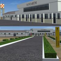
Santarem Airport in Brazil carries the SBSN designation and presents version 1.0 with taxiway signs. By Gustavo Luna, this freeware project highlights the SBSN code and the Santarem airport, preser…
 Brazil
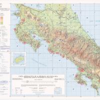
Version 2.0, credited to Fernando Angel G and Konrad Stainvorth S, centers on Costa Rican airfields nationwide and includes points of interest such as Parque de diversiones, Banco Nacional, and La …
 Costa Rica
openVFR collaborates with Markus Freyt to bring Germany POI data sourced from OpenStreetMap, enriching low-altitude navigation with forests, farmland, built-up areas, and landmark references. The p…
 Germany
Eduardo Mello credits the SWSI 3D project version 1.3, focused on Sinop Airport (OPS, ICAO SWSI) in Mato Grosso, Brazil, with coordinates derived from mapping data. It uses DDS files with mipmaps a…
Brazil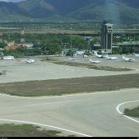
Located on Margarita Island, the SVMG aerodrome features two terminals for domestic and international flights, with most traffic between Margarita and Caracas, and is named Aeropuerto Internacional…
 Venezuela (Bolivarian Republic of)
Buenos Aires 2008 by Pablo Contouris centers on the end of the Paraná delta and a coastal strip from Escobar to La Plata, balancing performance with a realistic land appearance. It references the B…
 Argentina
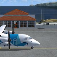
Lets Fly Association and Shigeru Tomino present Corvo Airport at LPCR in the Azores, Portugal as version two. Two image previews show the runway area, and attribution lists Lets Fly Association alo…
 Portugal
Two BGL variants orient at KPBI in West Palm Beach, created by Ray Smith, using ADE by Jon Masterson. KPBI_ADE_RS.BGL keeps conventional runway patterns while KPBI_ADE_CW_RS.BGL activates runway 13…
 United States of America
Baiyun International Airport (ZGGG) is updated by Ray Smith with a terminal expansion and the E3 and W3 concourses, plus a FedEx hub served by new taxiways and signage. Three BGLs—ZGGG_ADE_RS.BGL, …
 China
China
An enhancement of McGuire AFB (KWRI) near Wrightstown, New Jersey, adds extended parking with lighting, a fire station, and realigned aprons and taxiways that mirror reference diagrams and imagery,…
United States of America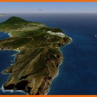
The St. Eustatius depiction centers on the FD Roosevelt airport TNCE in the Caribbean. It uses SbuilderX, Autogen Annotation, and Airport Design Editor 9x, and boat traffic may appear from source f…
 Bonaire, Sint Eustatius and Saba
Trabzon LTCG airfield and its surrounds in the eastern Black Sea region of Turkey present a VFR depiction with realistic object placement and autogen, along with photoreal elements supplied with Go…
 Turkey
World's shortest commercially serviced runway defines this airport rendition, which adds gates and a realistic terminal with animated people, and includes one static plane stationed for refueling a…
Bonaire, Sint Eustatius and Saba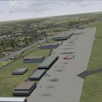
Liege airport in Belgium gains cargo ramp additions and more parking slots, a layout by Lee Marrow for cargo-focused operations. The approach relies on compatibility, maintaining alignment with exi…
 Belgium
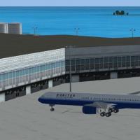
By Kambiz Agazi, this modification reworks Cyril E. King Airport to reflect 2010 specifications, introducing a new VOR A approach with transitions to Runway 10 and a reconfigured control tower, GA …
 Virgin Islands (U.S.)
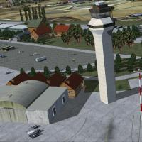
By Antoine Calleja, VNKT in Nepal receives a version 4 fix focused on end-of-runway areas, including light poles, a hangar, and vehicles. The correction improves these objects across runways, align…
 Nepal
Nepal
Version 1.0 enhances the Catalonian coastline, correcting the shoreline and placing 61 towns, 123 beaches, and 59 ports along the Barcelona area and Costa Brava. Files used include Catalunya_C_Colo…
 Spain
Spain
By Chris Carel, the project spans 23 seaplane bases along the East Coast, including Chalk's Key West (61FD) and Martha's Vineyard (KMVY), and adds custom objects with day-night visuals and animatio…
United States of America
Northern Passage maps an 80 to 120 nautical mile route along the East Coast, linking Old Town Airport, Maine, to Kenmore Air Harbor, Seattle, Washington, with stops across Maine, Vermont, New York,…
United States of America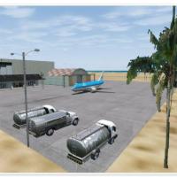
Willemstad Airport TNCC in Curacao receives an enhancement that expands the apron, adds a cargo area, and establishes a central parking lot, all implemented with ADE capabilities. Its scope reflect…
 Curaçao