Page 114
Searches the whole library — filter by sim & category on the results page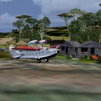
By Gera Godoy Canova, the Amazonas project of 1937 centers on the Amazon region with a Macchi 64 twin-engine amphibian, a Curtiss amphibian, and a Curtiss passenger aircraft. It supplies .BGL and .…
 Global (World)
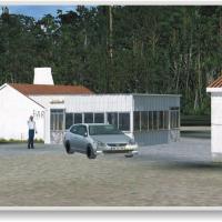
José Maia presents a freeware modification that overhauls a 20 by 20 kilometer area around Cerval Airfield near Valença do Minho, delivering newly built terrain and vegetation with custom autogen t…
 Portugal
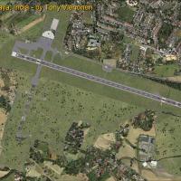
The modification relocates the runway and adjusts its length, and eliminates the closed runway 10/19. The changes add ATIS 127.05, implement ILS for runway 28 at 109.30, and introduce a new termina…
 India
India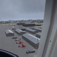
Oxnard Airport KOXR, located in Oxnard, California, USA, appears as an add-on with moving airport vehicles, ramp lighting, and people. Jimmy R. Martin designed it, and a few static aircraft populat…
 United States of America
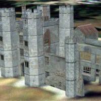
Located near Fareham, Hampshire, England, Titchfield Abbey appears as a ruin created by Simon Swallow. All models are built with GMAX, and the directory is named Titchfiled Abbey for placement in t…
 United Kingdom
By Samuel Devey, a gates signage enhancement for EGNH Blackpool adds taxiway signs to the gates to improve navigation. The modification targets the airport's default layout, presenting visible guid…
United Kingdom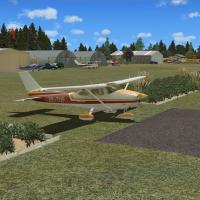
The South Waikato District Council administers Tokoroa Aerodrome (NZTO) in New Zealand, with Lawrie Roache and Robin Corn credited. A paved 2,800-foot runway forms the core, while the add-on uses V…
 New Zealand
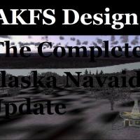
Wilson Malone of AKFS Design recalibrates Alaska navigation aids, listing 43 VORs, 61 NDBs, and 23 NDB/DME stations for a total of 127, with magnetic variation data and precise navaid positions bas…
United States of America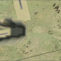
Ben Sawkin presents a Hoedspruit AFB enhancement in South Africa that corrects runway 27, previously sitting in a canyon. The creator relies on SBuilder, AFX, and TCalc002, and signs the work as ZS…
 South Africa
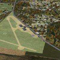
Rodgers Field near Pittsburgh becomes the newly added airport in a Pennsylvania ghost-airport set, expanding a forty-seven airport roster that previously existed but is now largely gone. The update…
United States of America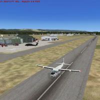
Kalispell City Additions at Kalispell, Montana, carries code S27 and adds two military-style hangars, one new-style hangar and a warehouse, along with taxiways and parking areas. Two start / landab…
United States of America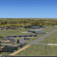
Potchefstroom Airport (FAPS) receives a freeware upgrade by Jacques Botha, featuring aligned runways, enhanced taxiways, and updated apron details aimed at a credible regional layout. The archive F…
South Africa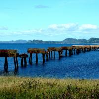
Argentia, established in the Dominion of Newfoundland, serves as a representation of the U.S. Navy base that operated from 1941 to 1994 and closed under BRAC. Version 1.0 focuses on the airfield an…
 Canada
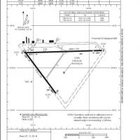
CZBB in British Columbia, Canada uses ADE v1.37 and follows a chart dated July 31, 2008. Runway 07/25 extends to 5606 feet and gains a VASI, with a revised layout including new taxiways and added s…
Canada
An airfield at Erie, Pennsylvania, designated KERI, receives apron adjustments to avoid highways, replacement of the terminal and most buildings, and added facilities such as a fire station, weathe…
United States of America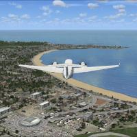
The first of three components centers on Colonia del Sacramento and the San Juan river, with extensions to Conchillas, River San Juan, Real San Carlos, Colonia, River Riachuelo, and coastlines. A s…
 Uruguay
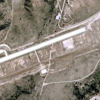
By Michael Mannschreck, the airfield sits in the California mountains inland from the coast, about 53 nm from KLAX and 12 nm from KNFG, and includes runway 4/22 with taxiways and turn-around points…
United States of America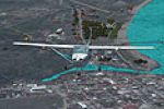
Photorealistic depiction of the Tela harbor in Honduras by Felix Romero Jr. arrives as a single asset labeled TELA, focusing on the Central American coastal region. The work notes geographic covera…
 Honduras
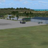
By Jacques Botha, this Mozambican airport project centers on Vilanculos, the gateway to the Bazaruto Archipelago, Mozambique's underwater national park. It references Vilanculos_X.zip, the FQVL_Vil…
 Mozambique
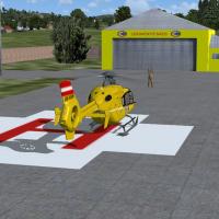
Virtual Legimento documents LHBB Helibase with two image files, both shown in the listing for potential users. A screenshot displays the helibase arrangement and confirms the two referenced images …
 Hungary