Page 129
Searches the whole library — filter by sim & category on the results page
Phase 2 expansion by Jason Morgan centers on a fictional Canadian airbase identified as CAN1. It features ILS on runway 29 at 110.75 and designates runway 11 as the only large-scale option for carg…
 Canada
Trevor Hannant updates the Wattisham tower setup by relocating the tower at EGUW from the runway center to a position nearer its true site at Wattisham Army base in the United Kingdom. It uses the …
 United Kingdom
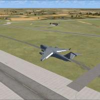
A USAF-operated facility in South Carolina supports C-17 training by the 437th and 315th Airlift Wings at Charleston AFB. Bare-base operations also occur at Shaw AFB and McEntire ANG Station with t…
 United States of America
An air cargo hangar becomes part of the layout at KFMN in Farmington, NM, enhancing the local aviation footprint. The author designs a hangar and vehicles at KHOB Hobbs, NM, and plans air cargo cov…
United States of America
La Drang in Vietnam anchors this assembly, spanning four sites including Pie Me special forces camp, LZ Xray, LZ Falcon, and LZ Albany, with Alan Mccarthy credited as the author and the contributor…
 Viet Nam
Kris Kringle Industries operates CYKK, located just 20 miles from the North Pole, as the base of operations for Santa Claus and his elves, reindeer, and helpers. It uses custom AI traffic, by Andy …
 Global (World)
Two saved flights accompany the training course, one for each supported version, by Andy Johnston, and it guides pilots through the twists and turns of a large pipe, designed for a flight simulator…
Global (World)Reben Niemand serves as the sole author for Tafelberg, presenting a concise title associated with a single creator. The designation establishes Tafelberg's identity and confirms a single creator be…
 South Africa
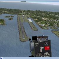
Port Aransas, Texas hosts Mustang Beach Airport (KRAS); ADE creates elements from a library, by Jimmy R. Martin. This edition expands a prior version with additional area for adding objects, and al…
United States of America
Courtenay Airport sits 2.5 nautical miles west of Courtenay on Vancouver Island, British Columbia, as a private field enhanced to handle up to three light aircraft. The airstrip favors VFR approach…
Canada
Mike d. Dalgleish creates a project that replaces a 380 miles stretch of the Angara from near Lake Baikal northward, leaving the original coastlines intact while filling the waterway with accurate …
 Russian Federation
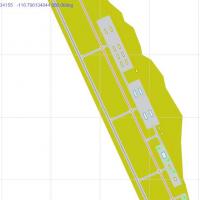
An ADEX-based enhancement for the Nevada site near Tonopah, by Ralph Danielson, is created with Airport Design Editor 9x. It adds aprons, parking, taxiways and stock airport buildings, using three …
United States of America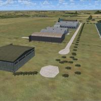
David James Collyer creates Fishburn Airfield, a small VFR airfield north of England in the United Kingdom. Its ICAO code is XFSH, and the asset resides in a folder named Fishburn locally on disk t…
United Kingdom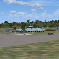
Art Poole offers a freeware enhancement for Sebastian Municipal Airport (X26) in Florida, replacing an older runway with a newly commissioned one and adding a GA terminal, while revising surroundin…
United States of America
Located south of Pará in the Amazon Forest, Brazil, Cachimbo facility is documented by Jorge Amengol, and amg-SBCC_V1.zip contains two directories, amg-SBCC and amg-SBCC_LC, for organizing related …
 Brazil
Lambertsbaai airfield, identified as FALR, sits in South Africa and Jacques Botha makes it available as freeware. It features custom designed buildings alongside default library objects, with acces…
South Africa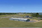
Frank Auger focuses on W91, the airport near a Virginia lake and the nearby seaport VA48, roughly 25 miles southeast of Roanoke. Four folders are included: three area folders and an object library …
United States of America
Two BGLs, KELY_ADEX_MH and KELY_ADEX_MH_CVX, use ADE 9X to update taxiways and runways at the Nevada field according to FAA data and Google satellite images. The package adds a terminal with Jim Dh…
United States of America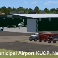
KUCP, registered as FAA LID UCP, sits four nautical miles northwest of downtown New Castle in Union Township, Pennsylvania, and operates under the Lawrence County Airport Authority. The field spans…
United States of America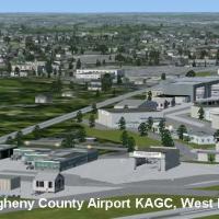
Allegheny County Airport, AGC, located in West Mifflin, PA, ranks fifth in the state by operations, and John B. Loney, Jr. delivers a freeware revision with input from David J. Zumbo. The baseline …
United States of America