Page 131
Searches the whole library — filter by sim & category on the results page
The NY0 field in Johnstown, New York, receives improved aprons, a revised boundary fence, and parking spaces with runway markings aligned to real-life standards. Jim Cook adds hangars, a restaurant…
 United States of America
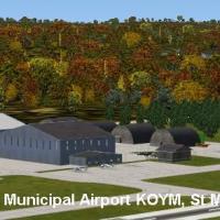
The Elk County, Pennsylvania airport KOYM (IATA STQ, FAA LID OYM) spans 283 acres and centers on a single runway 10/28, measuring 4,300 by 75 feet of asphalt. In the 12 months ending October 31, 20…
United States of America
Trevor Clark creates a Linley Hill airfield project near Beverley in East Yorkshire, featuring animated objects and full auto-gen trees. It requires the UKVFR.ZIP file from the UK VFR object librar…
 United Kingdom
This refinement for the Hopedale site uses standard visuals and stock objects, requiring no extra libraries. By JPS, it ships three files (1B6_ADEX_JPS.BGL, 1B6_ADEX_JPS_CVX.bgl, 1B6_JPS.bgl) and a…
United States of America
An add-on by Adam Waiser locates the Pik Airstrip on the southern Golan Heights, 0.5 mile east of Kibbutz Affik and 5 miles east of the Sea of Galilee along road 98 between Katzrin and Kibbutz Mavo…
 Israel
A winter version of PANN Nenana Municipal Airport in Alaska updates runways and paths to reflect ice and snow: the water runway becomes ice, grass becomes snow, and dirt pathways turn to snow, whil…
United States of America
Stoke EG93 in Kent, England presents a sloping, curved grass runway with static aircraft and an animated windsock, paired with a CTAF frequency. The model, by Keith Hackett, uses Gmax and works wit…
United Kingdom
Kearney Regional Airport in Nebraska (KEAR) shows added objects and lighting, including a drag strip for realism. Acceleration enables the items to appear, and the work is credited to Jimmy R. Mart…
United States of America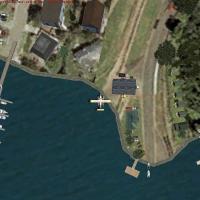
A fictitious day park and float plane base sits at the mouth of Indian Arm, northeast of downtown Vancouver, featuring a water runway viewable on GPS and an NDB with a frequency of 225.0 and a rang…
 Canada
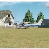
CSK8, located in Surrey, British Columbia, sits a short distance south of YVR and serves ultralight aviation enthusiasts. The modification replaces the airstrip with a visual ground reference of th…
Canada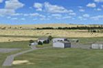
Freeware add-on by Jacques Botha reproduces Kuruman Airfield (FAKU) in the Northern Cape, aligning with real coordinates for an authentic ground layout. It relies on default assets from the core li…
 South Africa
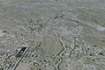
Covering Wickenburg, E25, Arizona, this photo-based layout sits about 60 miles northwest of Phoenix and shows a recently extended runway. Kevin Burns signs the project, noting that almost every bui…
United States of America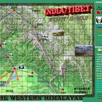
Arunachal Pradesh expansion adds new airfields, landclass, and various airport objects across the northeast Indian region. The ARUNACHAL directory houses two subfolders for imagery and BMP assets, …
 India
India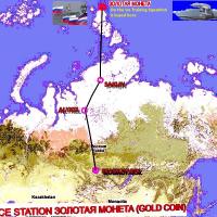
Gera Godoy Canova crafts a Siberia, Russia–based addition tied to Ice Station. It lists .BGL and .CL files organized in a primary data subdirectory, with .BMP image files stored in a separate folde…
 Russian Federation
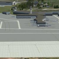
KOAK's Oakland upgrade provides two .bgl files, KOAK_KA.bgl and KOAK_KA_CVX.bgl, to replace default airport data. It tunes AI gate assignments for MyTraffic X 5.2 and WOAI, while still compatible w…
United States of America
Jim Cook leads two files, KBVS_AFX_JC.bgl and KBVS_JC.bgl, for the KBVS site near Burlington and Mount Vernon. The work refines aprons and taxiways, restores missing surfaces from up-to-date refere…
United States of America
Mercer Airfield NZME sits in the Waikato between Auckland and Hamilton, presented as freeware for private, non-commercial use. Lawrie Roache designs the airfield with aprons and taxiways, while Rob…
 New Zealand
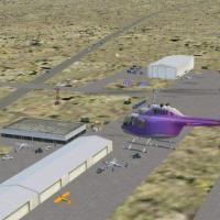
With airport code KOLS in Nogales, Arizona, default library objects and EDSG ramp lights illuminate the field. By Jimmy R. Martin, the work centers on the Nogales area and uses two folders that hou…
United States of America
IGQ, Lansing Municipal, appears in version v1.00.00 with Gregory Van Den Ham credited as creator. PAPI lights illuminate all runways and corrections fix runway markings, while taxiways undergo chan…
United States of America
Brandis Waldpolenz (EDBN) in Sachsen, Germany, is authored by Guido Weis and distributed as freeware. The archive remains freeware, and people share it complete and unaltered, recalling Luftwaffe t…
 Germany