Page 46
Searches the whole library — filter by sim & category on the results page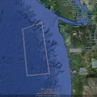
In the Pacific, a carrier group travels in a square pattern to better locate the fleet. The saved flight uses the default F-18 behind the ships, and the USS_NIMITZ_IKE_VERSION2.ZIP file is by Javie…
 United States of America
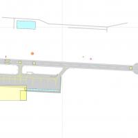
Version 2 for EGLC in the UK adds accurate touchdown zone markings, along with new parking areas and a taxiway to the runway, and is built with ADE9x. Five EGLC_ADEX files accompany the archive for…
 United Kingdom
Bruce Fitzgerald presents an International Space Station pass over KPAM, positioned at 900,000 ft above Tyndall AFB, Florida, with autonomous reach to 600,000 ft and a brief de-orbit toward KSC. Th…
United States of America
OSDI in Syria receives enhancements by Salim Unuver and Vedat Sencan, with references FSX_DMFX.ZIP and OSDI_FIX.ZIP. The setup includes moving gates and hangar doors, with NAV2 frequencies of 114.5…
 Syrian Arab Republic
A Gabon-based air facility carries the FOOL code, and d'Oliveira Thomas signs the work. A Leon Mba FOOL repertory exists for inclusion in the collection, linking the facility's identity to the crea…
 Gabon
Gabon
Lee Marrow leads a refined rebuild of Luanda’s international airport facilities, adding new parking stands, revised taxi routes, and expanded ramp objects to reflect busy ground operations. Night l…
 Angola
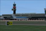
NL2000 v4.02 EHRD edition covers Rotterdam The Hague Airport, with terminal structures, hangars, and precise layouts anchored in southwestern Netherlands. It blends surrounding highways and city bl…
 Netherlands
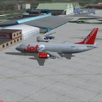
By Ian Broadbent, the project is built from scratch and based on photographs. It works with all versions and has a couple of landmarks near the airport in the United Kingdom, while a PDF manual acc…
United Kingdom
Version two expansion adds about 650 square kilometers of photoreal coverage around LESU and LECD in Spain, and corrects both airfields. Authored by Andy Aundrias and requires ANDORRA-FSX.ZIP to op…
 Andorra
Three parts labeled 1, 2 and 3 focus on forest visuals at 50 cm resolution, spanning global coverage, by Aime Leclercq. BMP files listed also include 022b2....bmp, 022c2....bmp, 023b2....bmp, 024b2…
 Global (World)
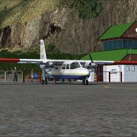
Two available screenshots document Milford Sound airstrip (NZMF) in New Zealand, credited to Lets Fly Association and Shigeru Tomino. They originate from two image references that present the site …
 New Zealand
Pantelleria Island hosts ICAO code LICG, an Italian airfield opened to national and international commercial traffic, located in the northwest part of Pantelleria. The facility operates two bitumin…
 Italy
Italy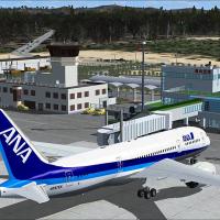
RJCW marks the Wakkanai Airport site in Hokkaido, Japan, with attribution to Shigeru Tomino of Lets Fly Association. The reference notes the geographic scope around the northern coastal town and as…
 Japan
Japan
By Thomas Schlechter, this first version for Dusseldorf International at EDDL adds gates V91–V96 (6), V86 (1), V61–V74 (10), V53–V31 (9), and V29–V01 (10), plus two GA parking spots and parking cod…
 Germany
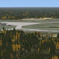
John Stinstrom continues the project that trains Navy aviators at Meridian KNMM in Mississippi using the T-45 Goshawk to practice carrier landings. He collaborates with Jim Dhaenens on a native ins…
United States of America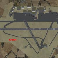
For EGGD UK, the Bristol aerodrome update introduces satellite imagery, certified NAT maps, and the new terminal complex. It is built with ADE9x, uses GMax created objects alongside default element…
United Kingdom
Across twenty eastern Caribbean airports, this installment, created by Chris Carel, expands the seaplane network with sea-plane docks and navigational aids across multiple islands. It pairs with ea…
Global (World)
Version 1.0 introduces five ferries from the BC Ferries fleet scattered along coastal routes, supported by a static library of five BC Ferries objects for placement. It covers 47 ports of call on 2…
 Canada
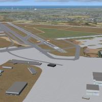
LLBG in Israel shows a relocated terminal and surrounding structures, using real landclass and apron polygons to reflect updated runway and taxiway layouts and navaids. Tomer Haim receives credit a…
 Israel
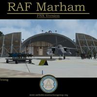
John Young leads a detailed representation of RAF Marham in the United Kingdom, crafted through the Airfield Construction Group. The work pairs with MAIW GR4 AI assets and uses photo ground tiles l…
United Kingdom