Page 6
Searches the whole library — filter by sim & category on the results page
Nice/Côte d’Azur airport (LFMN) is represented by three BGL files: LFMN_RS.BGL, LFMN_CVX.BGL, and LFMN_OBJ.BGL. PAPI is corrected for both runways and runway operations are set for takeoff on 4R/22…
 France
An update for Diosdad Macapagal International Airport in Angeles City re-draws aprons and taxiways to mirror imagery and extensive research from other sources, re-positions GA, maintenance, and car…
 Philippines
The PHNL project reworks the default Honolulu airport data, adding jetways at gates 49 and 52 and relocating parking to match real gate assignments, with extended mil_cargo and helipad placements a…
 United States of America
Credit goes to Alpha India Group for a revised Toncontin International layout that reworks aprons, taxiways, and the terminal, and adds RNAV and VORDME approaches for R02 and R20 based on May 2009 …
 Honduras
Istres-Le Tube in France, designed with the latest Airport Design Editor for FSX default airports, accommodates MAIW traffic packages for FS9 and includes helicopter traffic. Three BGLs named LFMI_…
FranceChhatrapati Shivaji International Airport, India, receives a layout dataset updated to reflect current taxiways with signs and numbered parking stands. The work, created by Sanjay Dutt, uses Airpor…
 India
India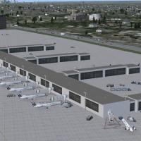
Cleveland Hopkins International Airport gains two separate cargo ramps for UPS and FedEx, while Runway 6R-24L is extended to 3034 meters and the crosswind Runway 10/28 is activated, enabling use of…
United States of America
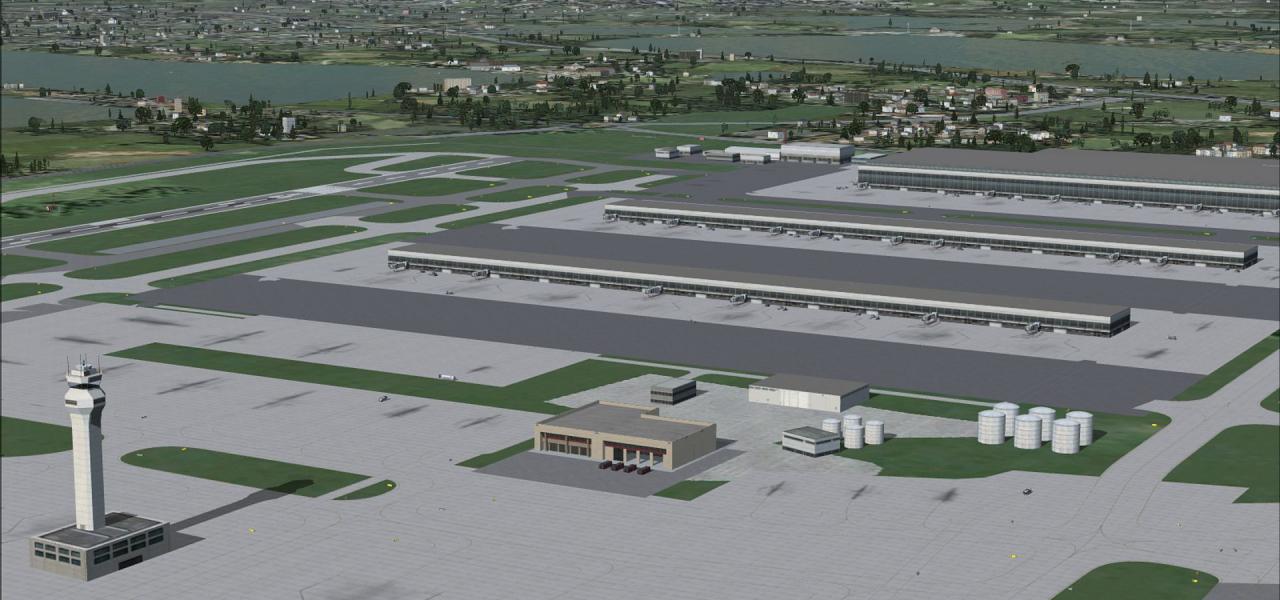
KLAS_2013 updates McCarran International Airport by adding a Terminal 3 with 14 gates and jetways, and revising Approach Procedures for Runways 01L and 25L per April 2013 plates. The change reassig…
United States of America
KMYR v1 alters the stock airport using a July 2010 FAA diagram and airnav data. Jetways are added, taxiway layout and signage are revised, and DHL/FDX cargo parking is included, with gate assignmen…
United States of America
Matthew Brooks of Alpha-India Group presents three BGLs for LEMG using ADE V1.38.04, named AIG_LEMG_ADE_MB_Default.BGL, AIG_LEMG_ADE_MB_Default_CVX.BGL, and AIG_LEMG_ADE_MB_Default_OBJ.BGL, with th…
 Spain
Spain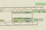
An airport layout adjustment for Taoyuan International in Taipei corrects gate and terminal assignments for major operators, removing extra gates and renaming the facility to Taoyuan International.…
 Taiwan, Province of China
Two BGL files, KCLE_ADE_RS.BGL and KCLE_ADE_CW_RS.BGL, support ADE v1.22 for the Cleveland area and include parking, numbered gates, animated jetbridges, and revised taxiways K, L2, and R1 along wi…
United States of AmericaTwo BGLs, RPLL_ADE_RS.BGL and RPLL_ADE_CW_RS.BGL, apply to the Manila-area airport, with the CW_RS variant activating crosswind runway 13/31 while the RS variant omits parking. ADE Home Edition was…
Philippines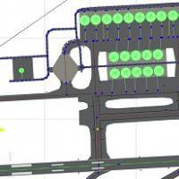
Billund Airport in Denmark receives a reworked layout with gates and taxiways aligned to real-world positions using data from the Danish Aeronautical Information Publication. This replacement ships…
 Denmark
Geilenkirchen AB in western Germany receives two BGLs, AIG_ETNG_ADE_JDW_Default.BGL and AIG_ETNG_ADE_JDW_Default_CVX.BGL, that re-draw aprons and taxiway layouts and expand parking for the NAEW&C f…
 Germany
Southwest England airfield EGHC receives a revised layout with accurately marked runways, some with edge lines, a terminal, fuel stations, two hangars, and correctly placed buildings, complemented …
 United Kingdom
Aeroparque, Buenos Aires, Argentina, gains an improved layout with relocated and new buildings, parking, a control tower, trees, and added freight and military ramps. Jorge Soldano Deheza creates t…
 Argentina
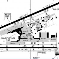
An updated Luis Munoz Marin International layout adds Terminal A with assigned gates, shifts terminals and traffic paths, and introduces the Puente Teodoro Moscoso Bridge with night lighting and of…
 Puerto Rico
Two BGL variants, named kphl.BGL (no crosswind) and kphl_cw.BGL (with crosswind), apply to Philadelphia International near the Delaware River, adding crosswind runway 17/35 operations and expanded …
United States of America
A single Melbourne Intl YMML.bgl file in Australia resizes several gates to accommodate large jets at the international terminal. Parking codes are aligned to terminals and the modification is vali…
 Australia