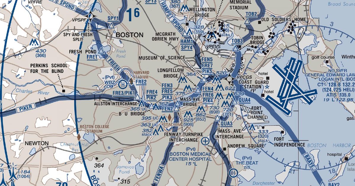
Official FAA digital chart — free GeoTIFF and PDF download
| Format | What you get | Size | |
|---|---|---|---|
| GeoTIFF | Georeferenced raster at 300 dpi, with world file and FGDC metadata | 24.9 MB | Download |
| Print-ready chart, no georeferencing | 50.4 MB | Download |
Not for navigation. For flight simulation and reference use only. Check the effective dates above, and obtain official charts from the FAA for real-world flight.

These are big files. This chart alone is 50.4 MB. Guest downloads are rate limited; PRO members get full-speed, unthrottled downloads across every chart and all 24,000+ add-ons in the library.
Go PROBoston Harbour sits at the centre of this compact sheet, with coverage extending west across Cambridge and the inner suburbs, north towards Lynn and Salem, and south through Quincy and Weymouth. The eastern portion reaches over the harbour islands and into Massachusetts Bay.
The setting is distinctly metropolitan and coastal. Dense development surrounds the Charles and Mystic rivers, while peninsulas, tidal inlets and islands break up the shoreline. Inland, the landscape becomes more suburban and gently rolling, in contrast with the open water and intricate harbour edge to the east.
The Helicopter Route Chart concentrates on the tightly defined urban and harbour area where the city’s waterways, coast and built-up districts provide the essential geographic framework. Boston’s Terminal Area Chart covers the same place within a broader terminal-region view, making it better suited to understanding the city in relation to the wider eastern Massachusetts area. Used together, the two products offer focused helicopter-route presentation alongside broader regional context.
| ID | Airport | City | Elev | Rwys | Longest |
|---|---|---|---|---|---|
| KBOS BOS | General Edward Lawrence Logan Intl | BOSTON, MA | 19 ft | 6 | 10,083 ft |
1 public-use airports within this chart's coverage, ordered by runway length. Source: FAA NASR 28-day subscription.
It spans 42.2°N to 42.5°N and 71.3°W to 70.7°W. Airports on the sheet fall within Massachusetts. The full list of public-use airports within its coverage is on this page.
Take the GeoTIFF if you are loading the chart into moving-map software or a flight planner — it is georeferenced, so the software can place it correctly on a map, and it ships with a world file and FGDC metadata at 300 dpi (24.9 MB). Take the PDF to print it or read it on a second screen (50.4 MB); it is the same chart without georeferencing.
This is the FAA edition effective 3 September 2026, which is superseded on 29 October 2026. Visual charts are reissued every 56 days and we publish each new edition on the day it takes effect. It is for flight simulation and reference only — not for real-world navigation.
Yes, with no account required. FAA charts are United States Government works and are not subject to copyright protection in the US under 17 U.S.C. § 105. Guest downloads are speed-capped, so a sheet this size takes a while; PRO members download at full line speed and can take the whole family as one archive.

FAA public-domain products, mirrored unmodified. Fly Away Simulation is not affiliated with or endorsed by the FAA. Chart licensing and terms.

