Page 17
Searches the whole library — filter by sim & category on the results page
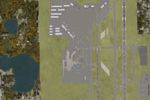
Targeted at bush flyers navigating the Alaska Range, this FSX add-on refreshes default terrain with upgraded mountain textures, custom runway and apron lighting, detailed airport enhancements, and …

Covering the Hawaiian archipelago portion of our library, this freeware FSX package refreshes PHLI / Lihue on Kauai with chart-matched taxiways, revised gate numbering, active crosswind logic, accu…
Wind calm over Tampa Bay, this freeware FSX rendition of KSPG Albert Whitted Airport reproduces the new control tower, waterfront park, updated taxiway layout and photoreal terminal using on-site i…
Ray Smith’s AFCAD overhaul for Chicago Midway International Airport KMDW updates Microsoft Flight Simulator X with AI-aware crosswind runways, re-drawn taxi links, precise airline gate mapping, enl…
Detailed Kahului Airport (PHOG) scenery for FSX adjusts Maui’s main gateway with up-to-date taxiway geometry, jetway-equipped concourses A–F, optimized AFCAD for AI schedules, dual-runway crosswind…
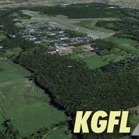
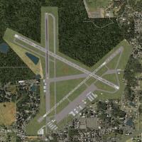
Glens Falls Floyd Bennett Memorial V3 brings KGFL in New York’s Adirondack foothills to Microsoft Flight Simulator X, reproducing the 5,000-ft asphalt strip, new business-class GA hangars, high-res…

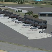
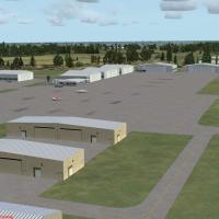
Florida’s Eglin AFB (KVPS) scenery upgrade for Microsoft Flight Simulator X refines the Panhandle hub with re-drawn aprons, extra military_combat and cargo hardstands, GA tie-downs, dual helipads, …
Covering Florida’s Atlantic playground, this FSX scenery rebuild inserts revised KDAB layouts, Daytona International Speedway grandstands, KDED, KOMN, KEVB, plus 1FD1 seaplane staging, jetties, mar…
Regional hub KOKC — Will Rogers World Airport expansion for FSX refines the AFCAD with full gate inventory, airline-coded parking, accurate taxiway links, GA ramps and updated approaches reflecting…
Covering KMKC in Missouri, this freeware download refreshes the United States Midwest scenery in FSX with accurate AFCAD geometry, hand-placed GMAX structures, photoreal ground polys, custom ramp l…
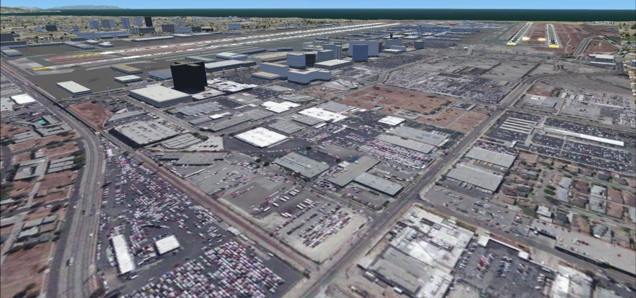
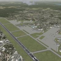
FSX KORD upgrade refines O’Hare International, Illinois, with chart-matched runway geometry—including 10C/28C—re-profiled taxiways, realistic gate coding for United, American, Star Alliance partner…

For Texas flyers running Microsoft Flight Simulator X, this KAUS add-on refreshes Austin-Bergstrom International with updated AFCAD built in ADE v1.47, accurate taxiway geometry, labelled signage, …
Covering the Atlantic shoreline near Cocoa Beach, this FSX upgrade recreates Patrick AFB (KCOF) with realigned taxiways, MIL Cargo stands, added helipads, default-library ground vehicles and update…
Covering KSFB in Florida, this FSX SP2 scenery update rebuilds Sanford Orlando International with accurate gate coding, extended 09R/27L to 6,000-plus ft plus working ILS, added Delta Connection Fl…
Covering Florida’s Space Coast hub, this FSX rendition of Melbourne International Airport (KMLB) supplies geo-accurate AFCAD layout, custom FBO and hangar models, refined landclass and parking code…
Bangor International Airport KBGR freeware scenery for Microsoft Flight Simulator X refines the Maine hub with expanded gate matrices, fresh general-aviation and cargo stands via a tailored AFCAD, …
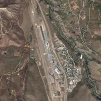
Flight Simulator X users mapping the United States Rocky Mountain sector can adopt this Aspen–Pitkin County, Colorado (KASE) scenery upgrade featuring a corrected 1.05-degree runway heading, realig…
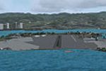
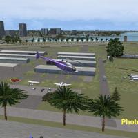
Ford Island Navy Base scenery for Microsoft Flight Simulator X brings the Pearl Harbor landmark on O‘ahu to life with frame-friendly BGL objects, adding combat ramps, static Navy aircraft, moored v…
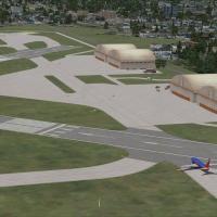
This FSX freeware rebuild of NAS Patuxent River (KNHK) in Maryland supplies updated AFCAD data, extra Military_Cargo and Military_Combat stands, a modeled firehouse with trucks, revised aprons, cor…
Covering five airfields—including Red Lion and South Jersey Regional—this freeware FSX / Microsoft Flight Simulator X add-on refines southern New Jersey’s GA network with re-drawn AFCAD geometry, a…