Page 12
Searches the whole library — filter by sim & category on the results page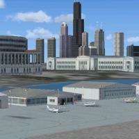
Chicago’s storied Meigs Field (KCGX) returns to FSX in this detailed yet restrained recreation of the former single-strip lakefront airport on Northerly Island, featuring custom FSDS3-modeled struc…

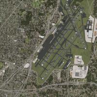
Georgia’s busy KATL gains corrected taxiway signage and an updated 111.75 MHz ILS for runways 10 and 28 in this AFCAD package, aligning the FSX airport layout with current FAA data to aid virtual a…
Fort Lauderdale–Hollywood International Airport KFLL gains a targeted FSX overhaul featuring extended taxiway C, realistic cross-wind runway logic through selectable BGLs, refreshed service roads, …

This freeware airport scenery for FSX SP2 refreshes La Guardia, New York (KLGA) with operative DME readouts, CTRL-J compliant jetways, revised concourses, a reworked control tower, and accurate air…
Covering 147 upgraded Alaska airfields, heliports and water aerodromes, this FSX scenery add-on slots into Microsoft Flight Simulator X’s library, supplying detailed Alaska bush flying locations, G…
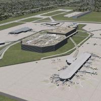
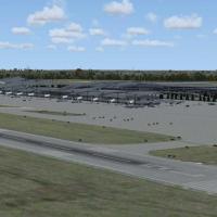
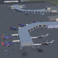
FSX-focused enhancement for Tampa International Airport KTPA updates the busy Florida gateway with a new terminal model, animated jetways, revised AFCAD stands, extended cargo ramps, GA shelters, p…
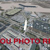
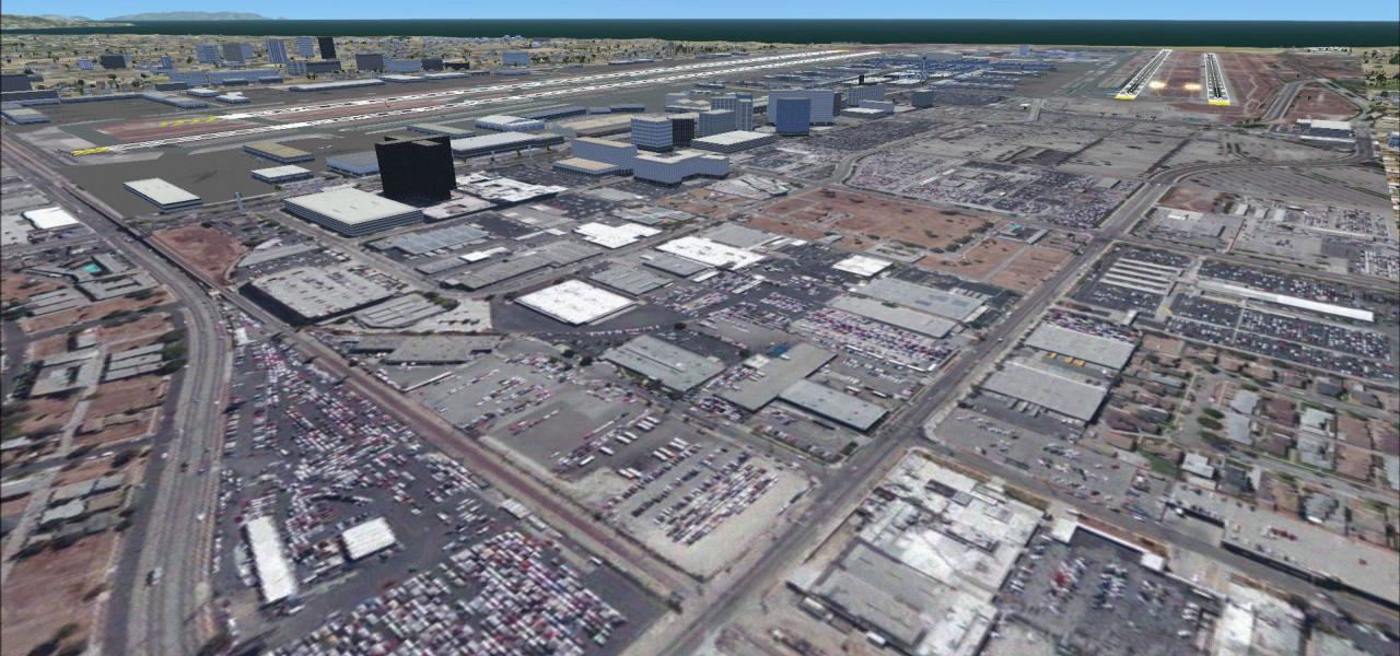
This FSX add-on refreshes Houston Hobby Airport (KHOU) with high-resolution photoreal ground polys, the current Y-shaped concourse, preserved 1940 terminal, custom warehouses, accurate gate coding,…
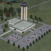
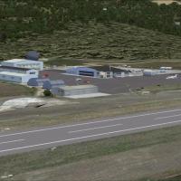
Anchorage’s subarctic hub comes updated for FSX with an ADE-built AFCAD featuring corrected runway 15/33 approaches, extended 7R/25L slab, functional crosswind logic, revised taxiway geometry, accu…

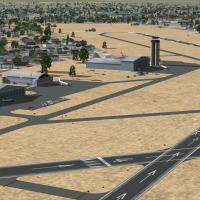
Designed for FSX and the Acceleration pack, this United States scenery update enriches California’s Edwards AFB (KEDW) with operational refueling pads and parked military hardware—including KC-135,…

This FSX scenery add-on anchors a default Nimitz-class carrier just south of PHNL and positions Coxxon’s Battlestar Galactica mesh 27,500 ft MSL, its port bay configured as a landable deck, giving …
Refined AFCAD update for KSFO San Francisco International brings corrected taxiway routing, current STAR/SID and RNAV procedures, revised ILS profile for 28L, realistic runway usage logic, refreshe…
Covering the 2010 configuration of Raleigh–Durham International Airport (KRDU) in North Carolina, United States, this FSX scenery add-on supplies custom Gmax terminals, cargo ramps, FAA control tow…
Lambert–St. Louis International Airport (KSTL) gains a 2008-era facelift for Flight Simulator X: runway 11/29 added, ILS/LDA 30L frequencies corrected, taxiway A6 re-tagged, fresh asphalt skirting,…
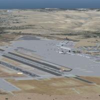
Honolulu’s PHNL gains a refreshed AFCAD for Microsoft Flight Simulator X, bringing crosswind runway logic, extended parking stands, revised taxiway links, a modeled fuel farm, helipad zoning, and a…
More than 133 western Kansas general-aviation strips are reworked here for FSX and every Prepar3D version; Steve Ziegler has updated runway geometry, aprons, parking stands and NDB entries with def…
Telluride Regional Airport (KTEX) scenery for FSX/Acceleration adds photoreal seasonal textures, high-resolution terrain mesh and ground-poly runways to north-western Colorado’s 9,078-ft MSL airfie…
Scoped rebuild of MCAS Miramar – Mitscher Field places the USMC’s San Diego aviation hub inside FSX and Prepar3D, layering refreshed aprons, Hangar 7, twin vertical landing pads, the southeast LHD …
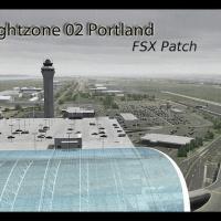
This lightweight patch repurposes FlightZone02 Portland (FS2004) for Microsoft Flight Simulator X, supplying revised AFX airport geometry, fresh exclusion BGLs and FSX-native autogen tree calls acr…
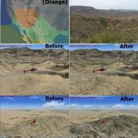
FSX Texture Mod – Southwestern USA Desert Textures V1.00 refreshes Region C landclass calls 003c2, 009c2 and 051c2 with greener xerophytic shrub layers, nuanced cactus patterns and denser woody scr…
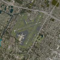
Tucson International (KTUS) for Microsoft Flight Simulator X provides a re-worked layout of this U.S. Southwest field with custom Gmax terminals, revised aprons and taxiways, current Jeppesen appro…