Page 16
Searches the whole library — filter by sim & category on the results pageWake Island PWAK scenery enhancement for Microsoft Flight Simulator X reshapes the atoll with precise reef polygons, corrected coastal lines and updated land-/waterclass, all authored in FSX-KML an…
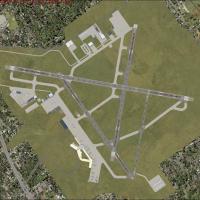
This AFCAD for Boise Air Terminal / Gowen Field KBOI realigns the default Flight Simulator X airfield with current FAA charts, refreshing taxiway geometry, runway links, and apron edges. Military a…
FSX pilots navigating Hawaii will find this AFCAD rebuild of Kona International–Keahole Airport (PHKO) delivers revised stand allocation, enlarged GA aprons, corrected taxiway geometry, hold-short …
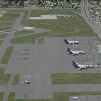
Built for FSX, this v1.0 package revises Seattle-Tacoma International KSEA to the 0812 AIRAC cycle, introducing runway 16R/34L with full ILS, expanded taxiway geometry including twy W and renamed T…
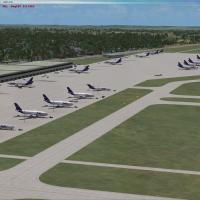
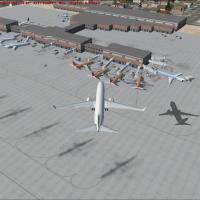
Covering the Puget Sound gateway, this FSX add-on supplies photoreal surface mapping, geo-aligned bespoke structures, revised AFCAD stands and taxiway data, AI aircraft plus vehicular traffic, deta…
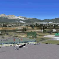
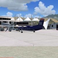
Flagstaff Pulliam Airport KFLG for Microsoft Flight Simulator X refreshes this high-elevation Arizona field with a scratch-built terminal, new fire house, corrected taxiway signage, servicing fuel …
Ray Smith’s ADE-driven AFCAD refresh for Fort Lauderdale–Hollywood Intl (KFLL) aligns the virtual field with current charts, tweaking taxiway geometry, signage, apron slots and vehicle circuits; op…
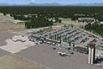
Ray Smith’s AFCAD update for Indianapolis International Airport KIND in FSX reorganises the midfield terminal, realigns taxiway geometry, enables crosswind runway use, allocates additional gates, a…

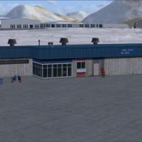
FSX rendition of Sitka Rocky Gutierrez Airport (PASI) in Alaska refines runway shoulders and turnoffs, corrects apron geometry, and updates coastal landclass for more credible terrain alignment, gi…

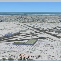
WashDCX overhauls Microsoft Flight Simulator X’s Washington, D.C. region with high-resolution orthoimagery, landclass tweaks, low-drawcall 3-D SketchUp landmarks—Air Force Memorial, WWII Memorial, …
Shez Ansari’s respected FS2004 scenery of Palm Springs International Airport (KPSP) now slots cleanly into FSX, delivering custom terminals, concourses and desert-toned ground polys while revising …
Republic Farmingdale Airport (KFRG) scenery for FSX brings Long Island’s reliever field into sharp focus with geo-referenced photoreal ground polys, corrected AFCAD, seasonal snow layers, custom-mo…

Covering Panama City’s new-build KECP hub, this FSX-only scenery enhancement (v3.0) refreshes Northwest Florida Beaches International with revised runway 16/34 data, tweaked landclass, recalibrated…
Covering the remote Adak Airport (PADK) in Alaska’s Aleutian chain of the United States, this FSX/Acceleration scenery pack supplies a custom terminal model, revised AFCAD, accurate taxiway signage…
Covering the busy KISP airfield within FSX, this Long Island MacArthur Airport scenery add-on swaps in a custom terminal, jetways, updated AFCAD parking, GA hangars, service vehicles and optional s…
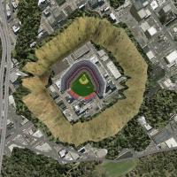
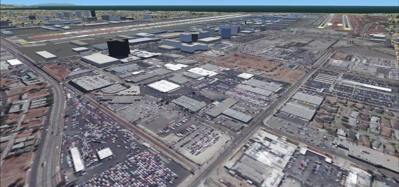
Designed for pilots seeking accurate VFR orientation in FSX, this Los Angeles scenery add-on corrects the Hollywood Sign and Dodger Stadium misplacement, refines terrain mesh around Chavez Ravine, …
Covering Tyndall AFB (KPAM) near Panama City, this FSX-focused AFCAD remake adds extensive Mil_Cargo and Mil_Combat parking, proper helipads, a fire-station ramp, corrected taxiway network and the …
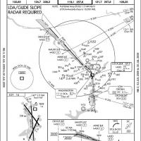
Second-edition AFCAD rebuild for FSX/P3D Reagan National Airport (KDCA), United States, re-codes runways 1/19 and 15/33 for realistic crosswind operations, limits 14/22 to wind-triggered use, refre…
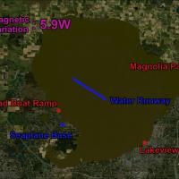
Adding the absent Orlando Seaplane Base (X09) on Lake Apopka, this FSX, P3D and FSW add-on inserts floatplane docks, AVGAS/MOGAS fuel pier, marked hazard poles, seawall lighting and scattered boat …
Covering Albuquerque International Airport KABQ for Microsoft Flight Simulator X, this AFCAD-based scenery refines terminal jetways, real-world gate codes, reworked cargo stands, cleared Kirtland A…