United States of America

Page 13

Sort
Reset
Preview screenshot

Merle K (Mudhole) Smith Airport

Cordova’s PACV in Alaska is rendered with revised aprons, accurate shoreline vectors, seasonal landclass and enhanced topography via FS Genesis mesh, complementing Ultimate Terrain Alaska. Tuned for FSX, the scenery updates taxiway lighting, static GA traffic and Prince William Sound references to support reliable IFR and VFR circuit training.

File Size
133.12 KB
Total Downloads
220
Star Rating
5/5
Screenshots
4
Preview screenshot

Arlington Municipal Airport

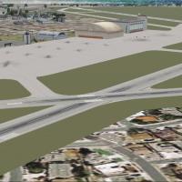
Virtual pilots exploring the United States in Microsoft Flight Simulator X can slot in this Arlington Municipal Airport (KGKY) scenery, delivering a reprofiled taxiway layout, relocated GA stands, a redrawn road network, functional Fire Station 12, fresh FBO and hangar models, autogen vegetation, light-poled car parks and stock-library static aircraft for realistic regional traffic.

File Size
9.53 KB
Total Downloads
220
Preview screenshot

Oxnard Airport

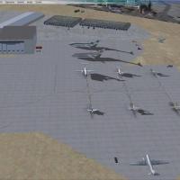
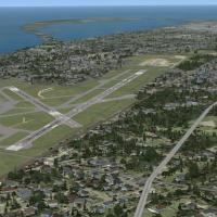
KOXR Oxnard Airport for Microsoft Flight Simulator X introduces animated ground support vehicles, variable-intensity ramp lighting, scattered personnel and a few static GA aircraft, all compiled with Airport Design Editor and Instant Scenery; the layout aligns with AI traffic schedules and blends with Ground Environment X textures, Active Sky X weather and Ultimate Terrain USA coverage.

File Size
418.09 KB
Total Downloads
219
Star Rating
4/5
Screenshots
2
Preview screenshot

Kalispell City Airport

This FSX add-on refreshes Kalispell City Airport (S27) in Montana with dual military-style hangars, a contemporary GA hangar, a warehouse, new taxiways, updated apron parking, static ground support vehicles, parked aircraft and two hard-surfaced helipads, giving Microsoft Flight Simulator X users a richer general-aviation and rotorcraft training environment.

File Size
1.57 MB
Total Downloads
215
Star Rating
1/5
Screenshots
1
Preview screenshot

Jean, Nevada

Jean Airport 0L7, the desert glider hub south of Las Vegas, receives an airport enhancement for Microsoft Flight Simulator X. Updated BGLs realign asphalt and dirt strips, tweak surfaces for tow operations, add Civil Air Patrol L-23 parking, refine taxiway links, pattern altitudes and field elevation, giving general-aviation and sailplane pilots accurate cues.

File Size
922.94 KB
Total Downloads
212
Screenshots
1
Preview screenshot

Kenai Municipal Airport

Covering Kenai Municipal Airport (PAEN) on Alaska’s Kenai Peninsula, United States, this FSX-only scenery injects photoreal ground polys, bespoke terminal architecture, updated runway elevations, precise taxiway signage, active approach lighting and ENA VOR/NDB data—useful for regional commuter hops, general-aviation sorties and IFR training along south-central Alaska routes.

File Size
5.15 KB
Total Downloads
212
Star Rating
3/5
No image available.

Schenectady County Airport

FSX users flying within New York State can load this re-worked Schenectady County Airport (KSCH) package, adding accurate taxiway geometry, expanded aprons, Stratton ANGB ramps, GA tie-downs, static C-130s and museum warbirds, plus updated parking codes for AI traffic. The scenery leverages Flight1 AFX/Instant Scenery tools to match current charts.

File Size
12.04 KB
Total Downloads
212
No image available.

Northeast Philadelphia Airport (KPNE)

Northeast Philadelphia Airport (KPNE) scenery for FSX SP2 rebuilds this East Coast general-aviation hub with bespoke 3-D terminals, FBO hangars and control tower generated from Google Earth data, an updated ADE layout, accurate taxiway signage and AI-traffic-ready stands, tuning polygon detail for smooth performance in Microsoft Flight Simulator X.

File Size
199.89 KB
Total Downloads
209
Preview screenshot

Casa Grande Municipal Airport

FSX rendition of Casa Grande Municipal Airport (KCGZ) introduces a detailed AFCAD, animated ground service vehicles, custom parking stands and photoreal objects across the Arizona desert apron, accompanied by tuned night lighting and seamless compatibility with MegaCity Phoenix, Ultimate Terrain X, Ground Environment X, Real Environment Extreme and MyTraffic X.

File Size
385.81 KB
Total Downloads
207
Star Rating
3/5
Screenshots
2
Preview screenshot

O22 Columbia Airport

FSX rendition of O22 Columbia Airport in California’s Sierra Nevada foothills adds a 4,673-ft asphalt strip, 2,600-ft grass runway, Unicom 123.05, Cal Fire tanker ramp, GA services, fly-in campground and static aircraft scenery; designed for Microsoft Flight Simulator X users seeking regional bush flying, aerial-firefighting or short-field practice.

File Size
8.51 MB
Total Downloads
206
Screenshots
10
Preview screenshot

1MA5 Southborough

Carved into a wooded ridge between the Mass Pike and Route 9, 1MA5 Southborough for FSX refreshes John Garabedian’s 1,500-ft private strip with accurate apron layout, taxi pathing, additional secondary roads and local VFR references—industrial parks, rail tanker yard, Cumberland Farms—using only default Microsoft Flight Simulator X assets, ensuring seamless integration for stock-mesh flyers.

File Size
3.35 MB
Total Downloads
204
Star Rating
2/5
Screenshots
3
Preview screenshot

Deer Valley Resort

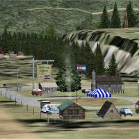
Between the Mogollon Rim and Roosevelt Lake, this FSX freeware scenery positions a private Deer Valley Resort fly-in near Grapevine, Arizona, adding a short dirt strip, dock, helipad, custom lodges, animated amusement rides and shoreline detail that complements VFR bush flying, floatplane operations and casual GA sorties across the Tonto Basin.

File Size
4.22 MB
Total Downloads
204
Preview screenshot

Springfield Massachusetts

Serving Springfield, Massachusetts along the Connecticut River, this FSX flight-sim scenery download inserts realistic downtown assets, the Big E fairgrounds, and surrounding New England landmarks into the terrain mesh, optimized for UT USA landclass. Crafted via Flight1 Instant Scenery, the modest add-on aids VFR navigation, pattern practice, and low-altitude sightseeing.

File Size
5.31 MB
Total Downloads
202
Preview screenshot

Pocono Mountains Municipal

FSX users flying the United States/Pennsylvania set will find Pocono Mountains Municipal Airport (KMPO) represented with an updated airport layout file, 5,001-ft asphalt runway 13/31, revised taxiway geometry, accurate field elevation, EZ-Scenery objects and default GA traffic, enabling credible pattern work and regional VFR routes across Monroe County’s plateau terrain.

File Size
738.75 KB
Total Downloads
198
Star Rating
3/5
Screenshots
2
Preview screenshot

Dubuque Regional Airport

Microsoft Flight Simulator X pilots seeking a tidy Midwest hub will find this Dubuque Regional Airport scenery refresh useful: correct airline gate coding, updated parking nodes, cargo apron tweaks, custom FBO and repair hangar, new terminal, fire station and static GA traffic, compiled via ADE for seamless U.S. terrain blending.

File Size
182.67 KB
Total Downloads
198
Star Rating
5/5
Preview screenshot

San Luis County Regional

San Luis County Regional Airport KSBP receives a concise overhaul for Microsoft Flight Simulator X, aligning runway, taxiway and apron geometry with up-to-date satellite imagery and employing stock library objects for hangars, GA ramps and support structures; well-suited to VFR pattern work or IFR coastal legs around Southern California, the package is authored in Airport Design Editor and delivered as lightweight BGL files.

File Size
282.74 KB
Total Downloads
196
Screenshots
1
Preview screenshot

Redding Municipal Airport

Pilots planning hops between NorCal airfields can load this KRDD AFCAD to gain geospatially correct runway geometry, revised taxiway signage, a newly carved northeast GA ramp, and default-library static clutter, all compiled via ADE into clean BGL/CVX layers tuned for stock Flight Simulator X terrain.

File Size
244.94 KB
Total Downloads
196
Star Rating
4/5
Screenshots
1
No image available.

Elmira/Corning Regional Airport

Flight-sim pilots flying Microsoft Flight Simulator X around New York’s Southern Tier will find this scenery upgrade for Elmira/Corning Regional Airport (KELM) useful; the package refines aprons, taxiway geometry and service roads, introduces a purpose-built terminal with jetways, an updated tower, airline-coded gates, fire station, plus stock-library vehicles and static aircraft that round out ramp activity.

File Size
10.74 KB
Total Downloads
194
Preview screenshot

Philadelphia Municipal Airport

KMPE Philadelphia Municipal Airport scenery refresh adds corrected runway 18/36 dimensions, updated taxiway geometry, enhanced ramp lighting and region-appropriate autogen around Neshoba County, delivering a low-impact FPS upgrade ideal for GA circuits, pattern work and cross-country hops across Mississippi in FSX and Prepar3D compatibility mode.

File Size
313.04 KB
Total Downloads
193
Star Rating
1/5
Screenshots
4
Preview screenshot

Custer County Airport (SD)

KCUT—Custer County Airport for FSX is a South Dakota scenery add-on that refreshes this Black Hills general-aviation strip with animated figures, ranch livestock, perimeter fencing, ramp lighting, and a small resort scene, all built via Instant Scenery 2 and aligned to FS Genesis mesh, UT USA X landclass and REX texture sets.

File Size
2.71 MB
Total Downloads
193
Screenshots
10

55 pages with 1097 downloads.

previous1234567891011121314151617181920212223...5455next