Page 14
Searches the whole library — filter by sim & category on the results page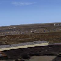
Located at KMHV in the arid Antelope Valley, this FSX add-on positions a fully populated Mojave Air & Space Port boneyard over MegaScenery Earth California photoreal terrain, utilising default libr…
LaGuardia (KLGA) AFCAD for Microsoft Flight Simulator X (Acceleration and SP2) refines the New York hub with November 2011 procedure data, revised SIDs, STARs and ILS paths, accurate taxiway geomet…
This FSX add-on recreates NAS Whiting Field’s North (KNDZ) and South (KNSE) airfields in Milton, Florida, supplying the new runway 32 ILS, MALSR approach lighting, extended 112.3 VORTAC radials, ou…
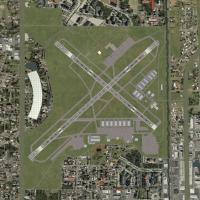
Salt Lake City International Airport (KSLC) for FSX gains crosswind-capable runway 14/32, corrected terminal night textures, chart-aligned taxiways, additional stands, rebuilt service roads and tow…
Updated AFCAD for Orlando International Airport KMCO refines the FSX default layout with ADE-generated airline-coded gates, expanded ramp parking, rebuilt service road network, additional retention…
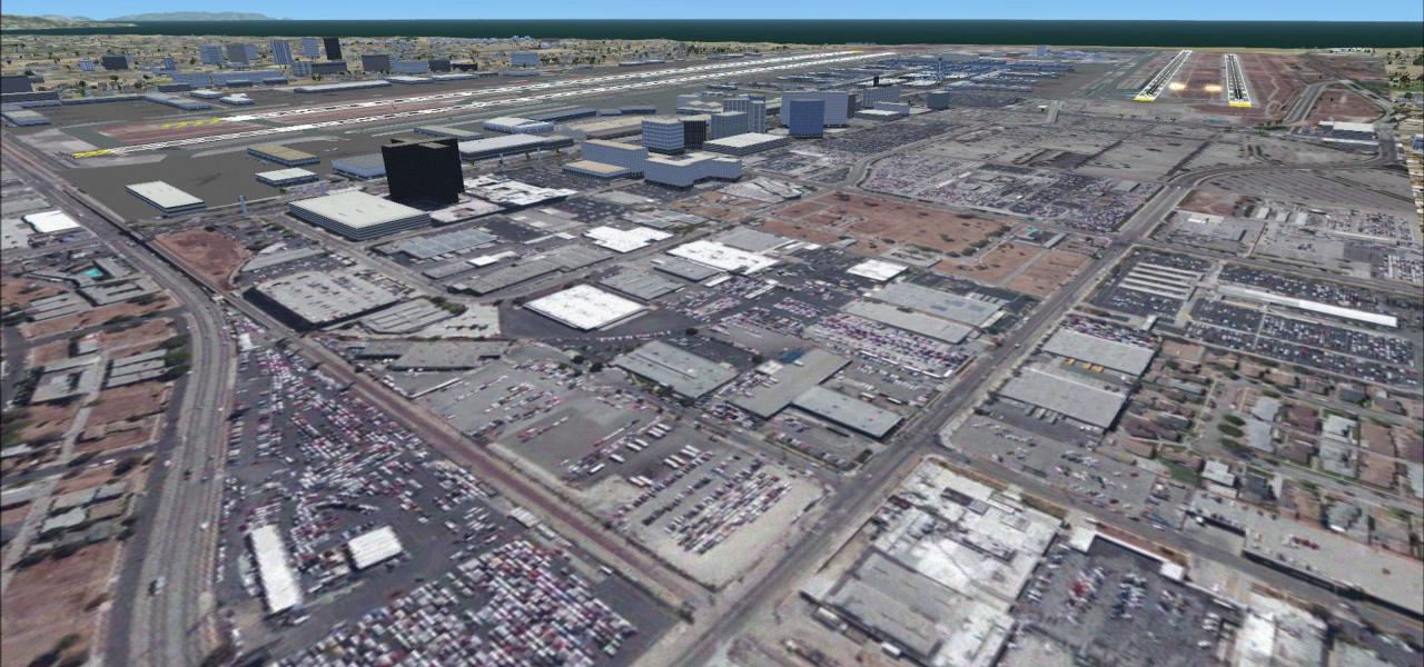
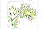
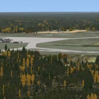
In this FSX scenery add-on, Des Moines International Airport KDSM in Iowa spans over 2,300 simulated acres, replacing default assets with FSDS-crafted terminals, accurate gate coding, updated AFCAD…
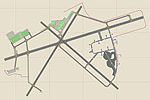
Washington Dulles International Airport (KIAD) gains a refreshed AFCAD for Microsoft Flight Simulator X by Ray Smith, introducing crosswind-enabled runways, re-numbered parking positions with A380-…
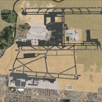
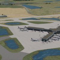
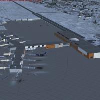
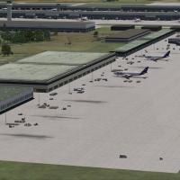
Optimised AFCAD for Microsoft Flight Simulator X models Minneapolis–St. Paul International (KMSP) with freshly charted 8,200-ft runway 17/35, revised taxiway geometry, airline-specific gate coding …

KAUS Austin-Bergstrom Airport scenery for Microsoft Flight Simulator X replaces the stock airfield with geo-corrected runways, high-resolution orthoimagery, SketchUp-based terminal and cargo models…
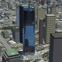
FSX 1 WTC Scenery V2 introduces a late-construction depiction of One World Trade Center to the United States skyline database, supplying accurate geo-coordinates, photoreal textures, dynamic night …
This freeware airport scenery upgrade for Microsoft Flight Simulator X refreshes Southwest Florida International (KRSW) and Page Field (KFMY) with a relocated terminal, expanded taxiways, revised a…
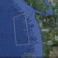
Naval task-force scenery positions a moving USS Nimitz carrier group on a square patrol off Washington’s Pacific shoreline, enabling FSX Acceleration aviators to rehearse F/A-18C Hornet traps, brea…

Anchored over Tyndall AFB, Florida, this FSX add-on scenery positions a static, satellite-grade International Space Station at roughly 900,000 ft, ideal for NASA Shuttle Atlantis drills, high-altit…
KNMM Naval Air Station Meridian for Microsoft Flight Simulator X is an FSX scenery add-on that recreates the U.S. Navy’s Mississippi training base with FSX-native GMAX objects, geo-referenced apron…
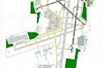
KATL AFCAD refresh aligns FSX and P3D traffic with Hartsfield-Jackson’s current five-strip layout, adding 10/28 east–west pavement, accurate taxiway routing, updated gate assignments, and revised a…
Covering 20 remote Alaskan aerodromes—including English Bay (KEB), Boswell Bay (AK97), Minchumina (PAMH), Buck Creek (AK98) and Fort Yukon (PFYU)—this Microsoft Flight Simulator X add-on blends EZ …

Kauai photoreal scenery for FSX delivers high-resolution orthoimagery across the entire Garden Island, refining Na Pali cliffs, Waimea Canyon and coastal shelf with 1 m/pixel textures; optimized au…
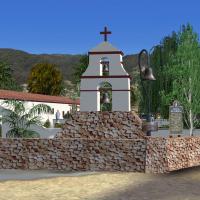
This FSX landclass upgrade places 11 Spanish-era missions—San Diego, Carmel, San Juan Capistrano, Santa Barbara, San Miguel and more—at their real-world coordinates, coupling bespoke 3D models, ada…
Naval Air Station Key West KNQX for Flight Simulator X gains a comprehensive airbase refresh: stock structures replaced with true-to-life U.S. Navy hangars, widened concrete aprons, realigned taxi …
Covering Wisconsin’s Milwaukee General Mitchell International Airport (ICAO KMKE) hub, this FSX scenery rebuild introduces revised pavement profiles, a lengthened 01R/19L, adjusted taxiway geometry…