Page 117
Searches the whole library — filter by sim & category on the results page
Frits Beyer creates Richards Bay Harbor in South Africa. The Richards Bay Harbor Folder accompanies this work and targets flying in the Richards Bay area, noting that it is not the real thing. The …
 South Africa
EGNC Carlisle by Tony Meredith includes Carlisle EGNC.bgl with airfield data and cvxCarlisle.bgl to flatten the airfield into photo imagery, plus two supplementary BGL files. The package references…
 United Kingdom
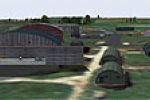
Three long runways define the Davidstow Moor site in the United Kingdom, with file names including Davidstow Moor XEGD.bgl, cvxDavids.bgl, XEGDbuildings.bgl, and Davidstowtower.bgl, authored by Ton…
United Kingdom
Deer Valley Resort sits beside Roosevelt Lake near Grapevine, Arizona (AZ), USA, as a fly-in retreat for the Deer Valley Flying Club members to relax, do some fishing, and visit the amusement park.…
 United States of America
Ryans Creek, NZRC, on Stewart Island receives a feature by Lawrie Roache and Robin Corn. VLC Object Libraries add vegetation depth, while compatibility notes indicate use with older environments an…
 New Zealand
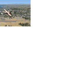
Meadowlark Airport traces its lineage from East Long Beach Airport, which opened in 1945, then became Sunset Beach in the mid-1950s and finally Meadowlark in 1963, serving general aviation near Hun…
United States of AmericaMontecristo Island presents a mountainous terrain with rocky ledges overlooking the sea and consists almost exclusively of granite, located halfway between Corsica and Italy at 42.34 N, 10.32 E, wi…
 Italy
Italy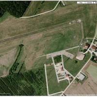
The airfield (LFEV) sits in Franche-Comté, eastern France near the Saône River and close to Switzerland, welcoming general aviation and ULM with several operators including a restoration specialist…
 France
An airport layout adds an 8500-foot reinforced concrete runway 125 feet wide and reinforced concrete taxiways of type 5566Xc, lit from dawn to dawn with bright illumination and lighted aprons. A te…
 Canada
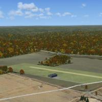
Two resulting .BGL files establish a new Franklin airport that bears PA99, accompanied by a video featuring a Franklin Sport 90. By Richard O. Finley, it remains freeware, and the Franklin airport …
United States of America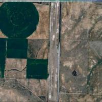
Operators deliver refined alignment across the Canyonlands region, updating Moab (KCNY), Monticello (U43), and Sky Ranch (UT53) to match revised runway headings and elevation profiles. Repositioned…
United States of America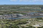
Dick Kittredge develops a Springfield area enhancement on the Connecticut River, featuring the Big E fair, using Instant Scenery and UT-FSX_Usa from Flight1 to position objects, and places the Spri…
United States of America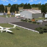
Two nautical miles northeast of Stratford in the Taranaki region, the site includes a clubhouse, a glider club hangar, three club hangars, and several privately owned structures. VLC object librari…
New Zealand
Version 1 centers on Agualeguas MMAL AGG near the town of Agualeguas in Nuevo Leon, Mexico, and includes the old MM44 and La Gloria airstrips, along with Gmax objects and landclass. Mexican Air For…
 Mexico
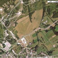
By Dominique M. L. Donzelot, Le Valdahon AB (LFHX) sits in eastern France, focuses on helicopters and light army aircraft during exercises, and carries the LFHX designation. It is not compatible wi…
FranceBar Rodoy designs the Masada airstrip LLMZ, which sits near Masada National Park in Israel about 100 meters from the Dead Sea. A folder labeled LLMZ shapes its layout, and Israel Landclass X appear…
 Israel
Jacques Botha provides a fix for Upington's FAUP airport that accompanies FAUP_UPI.ZIP, correcting bleedthrough at the control tower and the access to the fuel area. The adjustment also adds lighti…
South Africa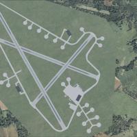
Lasham sits six miles southeast of Basingstoke in Hampshire and dates from November 1942, hosting Mosquito and Typhoon squadrons. Code UKLQ identifies the site, which closes in 1948 and later suppo…
United Kingdom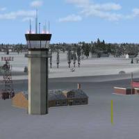
EDHF in Germany receives a photo-derived surface rendering with night lighting and seasonal variation, by Uwe Schweitzer. It replaces the old ground.bgl because the DEM.bgl flatten is included in t…
 Germany
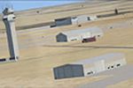
KAUS in Texas receives an ADE 9X-based update that reworks ramps, taxiways, and runways to align with current charts and imagery, adds FBOs, and updates the terminal with correctly numbered gates, …
United States of America