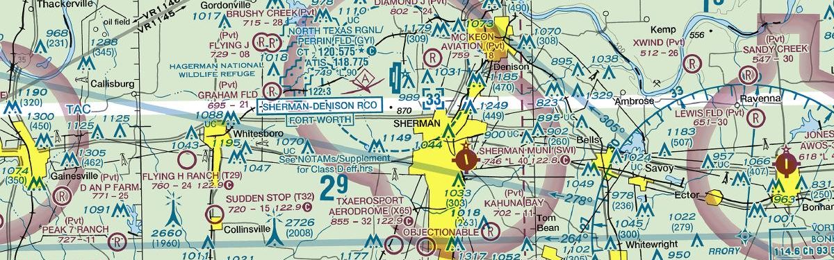
SHERMAN, TX · 4 FAA charts · cycle 1 Oct 2026
3 published instrument approaches: 2 RNAV (GPS), 1 VOR, serving 2 runway ends.
| Chart | Amendment | ||
|---|---|---|---|
| RNAV (GPS) RWY 16 | 0B | ||
| RNAV (GPS) RWY 34 | 0A | ||
| VOR/DME-A | 0D |
| Chart | Amendment | ||
|---|---|---|---|
| TAKEOFF MINIMUMS | — |
Minimums pages cover a whole volume, so the same document is shared by every airport in it.
From the FAA NASR 28-day subscription, cycle 1 Oct 2026.
| Service | Frequency | Call sign |
|---|---|---|
| CTAF | 122.8 |
Civil VHF frequencies from the FAA NASR 28-day subscription. Discrete sector and military frequencies are not listed.
| Runway | Length | Width | Surface | Lighting |
|---|---|---|---|---|
| 16/34 | 4,000 ft | 75 ft | Asphalt Poor | Medium intensity |
Runway and approach-aid data from the FAA NASR 28-day subscription.
33.6241390, -96.5861390
746 ft1 nm SEPaste the coordinates into a simulator’s world map to drop straight onto the field.
Published verbatim from the FAA NASR subscription. Abbreviations are the FAA's own.
| ID | Airport | City | Distance | Charts |
|---|---|---|---|---|
| KGYI | North Texas Rgnl/Perrin Fld | SHERMAN/DENISON, TX | 7 nm NW | 7 |
| F00 | Jones Fld | BONHAM, TX | 20 nm E | 5 |
| KDUA | Durant Rgnl/Eaker Fld | DURANT, OK | 21 nm NE | 4 |
| KTKI | Mckinney Ntl | DALLAS, TX | 27 nm S | 37 |
| KGLE | Gainesville Muni | GAINESVILLE, TX | 31 nm W | 5 |
| 1F4 | Madill Muni | MADILL, OK | 33 nm N | 2 |
| 7F3 | Caddo Mills Muni | CADDO MILLS, TX | 39 nm SE | 1 |
| KDTO | Denton Enterprise | DENTON, TX | 40 nm SW | 37 |
4 current FAA charts for Sherman Muni, including 3 instrument approachs. All are free to download as PDFs from this page, from the 1 October 2026 cycle.
CTAF 122.8. Full civil VHF list, with sector notes, is in the frequencies table on this page — from the FAA NASR subscription.
Sherman Muni has 1 runway. The longest is 16/34 at 4,000 ft by 75 ft, asphalt. Full runway dimensions, lighting and approach aids are listed on this page.
No ILS is published. In total KSWI has 3 published instrument approaches, of which 2 are RNAV (GPS).
No — Sherman Muni has no control tower. Traffic co-ordinates on a common frequency rather than with a controller, which is listed in the frequencies table on this page.
They are from the FAA cycle effective 1 October 2026, which is superseded on 29 October 2026. We publish each new cycle on its effective date. They are for flight simulation and reference only — not for real-world navigation.

Flying into KSWI? PRO members take all 4 charts as one ZIP instead of 4 separate downloads, at full line speed with no cap — plus every chart family archive and all 24,000+ add-ons in the library.
Go PRO
Not for navigation. For flight simulation and reference use only. Procedures are superseded on a 28-day cycle — obtain current official charts from the FAA for real-world flight.
FAA public-domain products, mirrored unmodified. Fly Away Simulation is not affiliated with or endorsed by the FAA. Chart licensing and terms.

