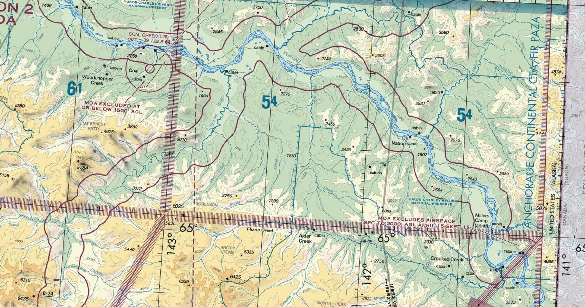
Official FAA digital chart — free GeoTIFF and PDF download
| Format | What you get | Size | |
|---|---|---|---|
| GeoTIFF | Georeferenced raster at 300 dpi, with world file and FGDC metadata | 56.5 MB | Download |
| Print-ready chart, no georeferencing | 117.5 MB | Download |
Not for navigation. For flight simulation and reference use only. Check the effective dates above, and obtain official charts from the FAA for real-world flight.

These are big files. This chart alone is 117.5 MB. Guest downloads are rate limited; PRO members get full-speed, unthrottled downloads across every chart and all 24,000+ add-ons in the library.
Go PROFrom the eastern edge of Alaska’s interior, this sheet follows the Yukon country through Dawson and north across the Arctic Circle towards the Northwest Territories. Its coverage combines broad river valleys with isolated uplands and increasingly rugged terrain, including the Yukon and Porcupine drainage country, the Ogilvie and Richardson ranges, and the southern approaches to the Brooks Range. The south-western corner reaches towards the Alaska Range, while much of the Canadian half covers remote northern Yukon.
Fairbanks continues the coverage westward across the lower part of the sheet edge, while Point Barrow takes over to the west of the northern sector. Anchorage adjoins at the south-west, covering routes that bend down from the Yukon interior towards south-central Alaska. This arrangement is particularly relevant for diagonal crossings: a track towards interior Alaska may meet Fairbanks or Anchorage depending on its southerly trend, whereas a high-latitude westbound track continues onto Point Barrow.
| ID | Airport | City | Elev | Rwys | Longest |
|---|---|---|---|---|---|
| CYOC | Old Crow | OLD CROW | 821 ft | 1 | 5,019 ft |
| CYDA | Dawson City | DAWSON CITY | 1,215 ft | 1 | 5,006 ft |
| PFYU FYU | Fort Yukon | FORT YUKON, AK | 447 ft | 1 | 5,000 ft |
| CYMA | Mayo | MAYO | 1,653 ft | 1 | 4,856 ft |
| PARC ARC | Arctic Village | ARCTIC VILLAGE, AK | 2,092 ft | 1 | 4,500 ft |
| 95Z | Bradley Sky-Ranch | NORTH POLE, AK | 483 ft | 1 | 4,100 ft |
| PAAR Z91 | Birch Creek | BIRCH CREEK, AK | 439 ft | 1 | 4,000 ft |
| PACI CIK | Chalkyitsik | CHALKYITSIK, AK | 548 ft | 1 | 4,000 ft |
| PAVE VEE | Venetie | VENETIE, AK | 574 ft | 1 | 4,000 ft |
| PAWB WBQ | Beaver | BEAVER, AK | 364 ft | 1 | 3,934 ft |
| L20 | Coal Creek | YUKON CHARLEY RIVERS, AK | 867 ft | 1 | 3,900 ft |
| CHP | Circle Hot Springs | CIRCLE HOT SPRINGS, AK | 870 ft | 1 | 3,669 ft |
| PAEG EAA | Eagle | EAGLE, AK | 907 ft | 1 | 3,600 ft |
| CYKD | Aklavik | AKLAVIK | 21 ft | 1 | 3,002 ft |
| CEZ2 | Chapman | CHAPMAN | 3,100 ft | 1 | 3,000 ft |
| PACR CRC | Circle City | CIRCLE, AK | 613 ft | 1 | 2,979 ft |
| PACE CEM | Central | CENTRAL, AK | 936 ft | 1 | 2,782 ft |
| PAAY CKX | Chicken | CHICKEN, AK | 1,640 ft | 1 | 2,500 ft |
| D66 | Delta Junction | DELTA JUNCTION, AK | 1,150 ft | 1 | 2,500 ft |
| BYA | Boundary | BOUNDARY, AK | 2,940 ft | 1 | 2,325 ft |
| 5BK | Black Rapids | BLACK RAPIDS, AK | 2,125 ft | 1 | 2,250 ft |
21 public-use airports within this chart's coverage, ordered by runway length. A further 24 private and restricted landing facilities are not listed. Source: FAA NASR 28-day subscription.
Approach plates and airport diagrams for every airport in the states this sheet covers:
It spans 63.4°N to 68.3°N and 147.7°W to 130.7°W. Airports on the sheet fall within Alaska. The full list of public-use airports within its coverage is on this page.
Take the GeoTIFF if you are loading the chart into moving-map software or a flight planner — it is georeferenced, so the software can place it correctly on a map, and it ships with a world file and FGDC metadata at 300 dpi (56.5 MB). Take the PDF to print it or read it on a second screen (117.5 MB); it is the same chart without georeferencing.
This is the FAA edition effective 3 September 2026, which is superseded on 29 October 2026. Visual charts are reissued every 56 days and we publish each new edition on the day it takes effect. It is for flight simulation and reference only — not for real-world navigation.
Fairbanks to the west, Anchorage to the south-west and Point Barrow to the west. Each is linked from this page, so a route running off one edge can be continued on the next sheet.
Yes, with no account required. FAA charts are United States Government works and are not subject to copyright protection in the US under 17 U.S.C. § 105. Guest downloads are speed-capped, so a sheet this size takes a while; PRO members download at full line speed and can take the whole family as one archive.

FAA public-domain products, mirrored unmodified. Fly Away Simulation is not affiliated with or endorsed by the FAA. Chart licensing and terms.

