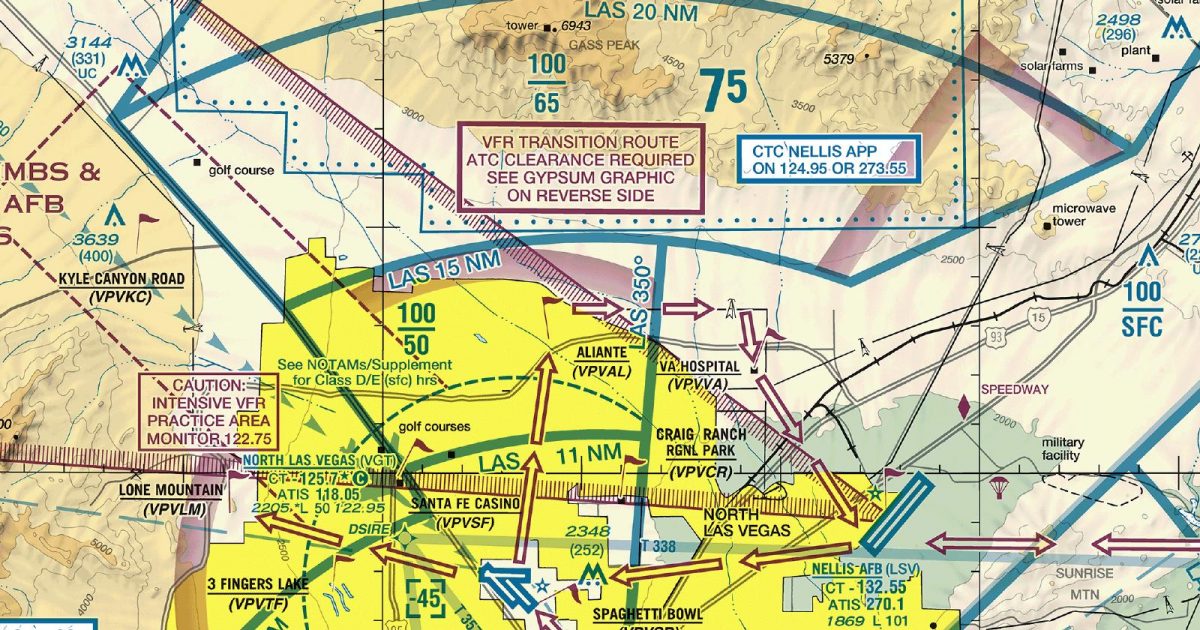
Official FAA digital chart — free GeoTIFF and PDF download
| Format | What you get | Size | |
|---|---|---|---|
| GeoTIFF | Georeferenced raster at 300 dpi, with world file and FGDC metadata | 27.9 MB | Download |
| Print-ready chart, no georeferencing | 55.5 MB | Download |
Not for navigation. For flight simulation and reference use only. Check the effective dates above, and obtain official charts from the FAA for real-world flight.

These are big files. This chart alone is 55.5 MB. Guest downloads are rate limited; PRO members get full-speed, unthrottled downloads across every chart and all 24,000+ add-ons in the library.
Go PROLas Vegas Valley occupies the centre of this sheet, framed by the Spring Mountains to the west and the rugged desert ranges surrounding Lake Mead to the east. Coverage extends west across Pahrump Valley, north into sparsely settled southern Nevada, and east towards the Colorado River and the edge of north-western Arizona. The southern portion reaches across the Mojave Desert, where broad basins, isolated ridges and dry washes contrast sharply with the dense urban pattern of Las Vegas.
The Terminal Area Chart concentrates its scale on the Las Vegas metropolitan area and the adjoining mountain, reservoir and desert corridors. That enlarged view is particularly useful for simulator flights transitioning between the built-up valley and nearby terrain, where short distances can bring marked changes in relief and visual character.
The Sectional Aeronautical Chart covering the same area places Las Vegas within a much wider regional setting. It is the better companion for longer routes across southern Nevada, eastern California and north-western Arizona, while this sheet keeps the terminal region prominent.
| ID | Airport | City | Elev | Rwys | Longest |
|---|---|---|---|---|---|
| KLAS LAS | Harry Reid Intl | LAS VEGAS, NV | 2,183 ft | 4 | 14,835 ft |
| KHND HND | Henderson Exec | LAS VEGAS, NV | 2,491 ft | 2 | 6,501 ft |
| KBVU BVU | Boulder City Muni | BOULDER CITY, NV | 2,203 ft | 2 | 5,103 ft |
| KVGT VGT | North Las Vegas | LAS VEGAS, NV | 2,205 ft | 3 | 5,005 ft |
| 1G4 | Grand Canyon West | PEACH SPRINGS, AZ | 4,816 ft | 1 | 5,000 ft |
| U08 | Perkins Fld | OVERTON, NV | 1,365 ft | 1 | 4,811 ft |
| 0L7 | Jean | JEAN, NV | 2,835 ft | 2 | 4,600 ft |
| 74P | Calvada Meadows | PAHRUMP, NV | 2,726 ft | 2 | 4,081 ft |
| U30 | Temple Bar | TEMPLE BAR, AZ | 1,549 ft | 1 | 3,500 ft |
| 0L9 | Echo Bay | OVERTON, NV | 1,535 ft | 1 | 3,400 ft |
| 3L2 | Sky Ranch | SANDY VALLEY, NV | 2,599 ft | 2 | 3,340 ft |
| L25 | Pearce Ferry | MEADVIEW, AZ | 2,941 ft | 1 | 2,900 ft |
| L61 | Shoshone | SHOSHONE, CA | 1,568 ft | 1 | 2,380 ft |
13 public-use airports within this chart's coverage, ordered by runway length. A further 9 private and restricted landing facilities are not listed. Source: FAA NASR 28-day subscription.
Approach plates and airport diagrams for every airport in the states this sheet covers:
It spans 35.6°N to 36.8°N and 116.4°W to 113.8°W. Airports on the sheet fall within Arizona, California and Nevada. The full list of public-use airports within its coverage is on this page.
Take the GeoTIFF if you are loading the chart into moving-map software or a flight planner — it is georeferenced, so the software can place it correctly on a map, and it ships with a world file and FGDC metadata at 300 dpi (27.9 MB). Take the PDF to print it or read it on a second screen (55.5 MB); it is the same chart without georeferencing.
This is the FAA edition effective 3 September 2026, which is superseded on 29 October 2026. Visual charts are reissued every 56 days and we publish each new edition on the day it takes effect. It is for flight simulation and reference only — not for real-world navigation.
Yes, with no account required. FAA charts are United States Government works and are not subject to copyright protection in the US under 17 U.S.C. § 105. Guest downloads are speed-capped, so a sheet this size takes a while; PRO members download at full line speed and can take the whole family as one archive.

FAA public-domain products, mirrored unmodified. Fly Away Simulation is not affiliated with or endorsed by the FAA. Chart licensing and terms.

