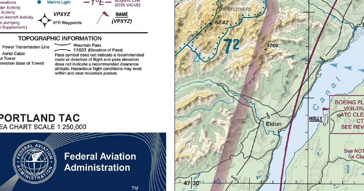
Official FAA digital chart — free GeoTIFF and PDF download
| Format | What you get | Size | |
|---|---|---|---|
| GeoTIFF | Georeferenced raster at 300 dpi, with world file and FGDC metadata | 36.2 MB | Download |
| Print-ready chart, no georeferencing | 72.9 MB | Download |
Not for navigation. For flight simulation and reference use only. Check the effective dates above, and obtain official charts from the FAA for real-world flight.

These are big files. This chart alone is 72.9 MB. Guest downloads are rate limited; PRO members get full-speed, unthrottled downloads across every chart and all 24,000+ add-ons in the library.
Go PROThe lower Columbia corridor anchors this sheet, which stretches from south-west Washington across the Portland area and into Oregon’s northern Willamette Valley. Its western reach takes in the forested Coast Range, while the eastern side approaches the Cascade foothills. That compact span brings together a broad river valley, densely settled lowlands and rising, heavily wooded terrain—a distinctive mix for flights crossing between inland valleys and the Pacific Northwest’s hill country.
As a Terminal Area Chart, this product concentrates on the metropolitan and terminal environment at a larger scale than the Sectional Aeronautical Chart covering the same region. The sectional is the better companion for placing the area within a longer cross-country route; the terminal sheet gives more room to the lower Columbia and Portland-area setting itself. With no adjoining sheet of the same type, its coverage stands alone rather than continuing onto a neighbouring Terminal Area Chart.
| ID | Airport | City | Elev | Rwys | Longest |
|---|---|---|---|---|---|
| KPDX PDX | Portland Intl | PORTLAND, OR | 30 ft | 3 | 11,000 ft |
| KHIO HIO | Portland-Hillsboro | PORTLAND, OR | 207 ft | 3 | 6,600 ft |
| KMMV MMV | Mc Minnville Muni | MC MINNVILLE, OR | 162 ft | 2 | 5,420 ft |
| KTTD TTD | Portland-Troutdale | PORTLAND, OR | 38 ft | 1 | 5,399 ft |
| KSPB SPB | Scappoose | SCAPPOOSE, OR | 58 ft | 1 | 5,100 ft |
| KUAO UAO | Aurora State | AURORA, OR | 199 ft | 1 | 5,003 ft |
| KTDO TDO | Ed Carlson Meml Fld/South Lewis County | TOLEDO, WA | 373 ft | 1 | 4,479 ft |
| KKLS KLS | Southwest Washington Rgnl | KELSO, WA | 20 ft | 1 | 4,391 ft |
| 4S9 | Mulino State | PORTLAND-MULINO, OR | 259 ft | 1 | 3,425 ft |
| KVUO VUO | Pearson Fld | VANCOUVER, WA | 28 ft | 1 | 3,275 ft |
| 7S9 | Lenhardt Airpark | HUBBARD, OR | 165 ft | 1 | 2,956 ft |
| 05S | Vernonia Muni | VERNONIA, OR | 650 ft | 1 | 2,940 ft |
| 2S6 | Sportsman Airpark | NEWBERG, OR | 181 ft | 1 | 2,755 ft |
| 1W1 | Grove Fld | CAMAS, WA | 429 ft | 1 | 2,710 ft |
| W52 | Goheen | BATTLE GROUND, WA | 292 ft | 2 | 2,565 ft |
| 7S3 | Stark'S Twin Oaks Airpark | HILLSBORO, OR | 170 ft | 1 | 2,465 ft |
| W56 | Fly For Fun | VANCOUVER, WA | 297 ft | 1 | 2,434 ft |
| 17S | Chehalem Airpark | NEWBERG, OR | 190 ft | 1 | 2,285 ft |
| W27 | Woodland State | WOODLAND, WA | 29 ft | 1 | 2,245 ft |
| 03S | Sandy River | SANDY, OR | 704 ft | 1 | 2,115 ft |
| 4S4 | Skyport | CORNELIUS, OR | 174 ft | 1 | 2,000 ft |
| W58 | Cedars North | BATTLE GROUND, WA | 275 ft | 1 | 1,960 ft |
| 39P | Strom Fld | MORTON, WA | 941 ft | 1 | 1,810 ft |
23 public-use airports within this chart's coverage, ordered by runway length. A further 63 private and restricted landing facilities are not listed. Source: FAA NASR 28-day subscription.
Approach plates and airport diagrams for every airport in the states this sheet covers:
It spans 45.2°N to 46.6°N and 123.7°W to 122.0°W. Airports on the sheet fall within Oregon and Washington. The full list of public-use airports within its coverage is on this page.
Take the GeoTIFF if you are loading the chart into moving-map software or a flight planner — it is georeferenced, so the software can place it correctly on a map, and it ships with a world file and FGDC metadata at 300 dpi (36.2 MB). Take the PDF to print it or read it on a second screen (72.9 MB); it is the same chart without georeferencing.
This is the FAA edition effective 3 September 2026, which is superseded on 29 October 2026. Visual charts are reissued every 56 days and we publish each new edition on the day it takes effect. It is for flight simulation and reference only — not for real-world navigation.
Yes, with no account required. FAA charts are United States Government works and are not subject to copyright protection in the US under 17 U.S.C. § 105. Guest downloads are speed-capped, so a sheet this size takes a while; PRO members download at full line speed and can take the whole family as one archive.

FAA public-domain products, mirrored unmodified. Fly Away Simulation is not affiliated with or endorsed by the FAA. Chart licensing and terms.

