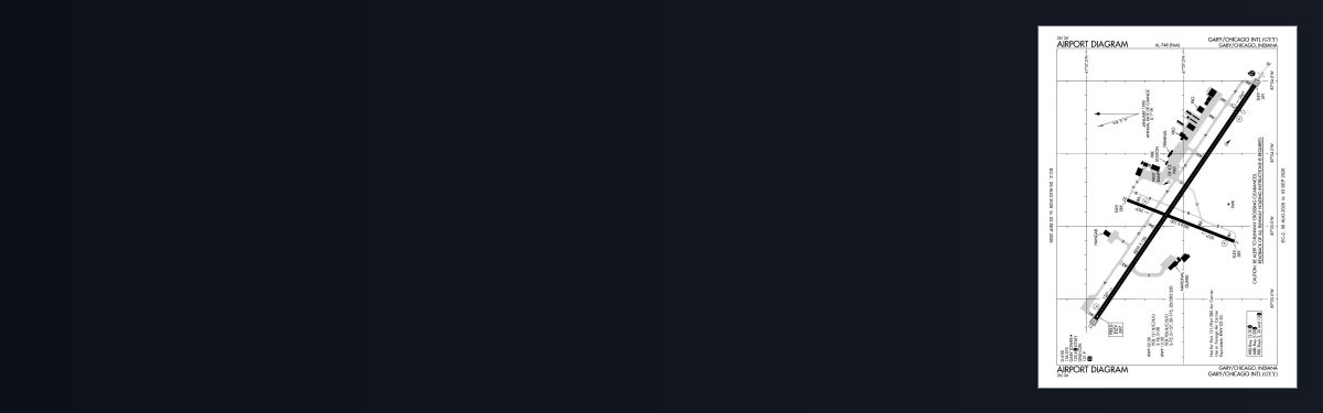
GARY/CHICAGO, IN · 20 FAA charts · cycle 1 Oct 2026
8 published instrument approaches: 2 ILS approaches, 6 RNAV (GPS), serving 4 runway ends.
| Chart | Amendment | ||
|---|---|---|---|
| ADELL EIGHT (RNAV) | — | ||
| BLOKR EIGHT (RNAV) | — | ||
| CARYN EIGHT (RNAV) | — | ||
| DARCY EIGHT (RNAV) | — | ||
| ELANR NINE (RNAV) | — |
| Chart | Amendment | ||
|---|---|---|---|
| LUCIT THREE (RNAV) | — | ||
| LUCIT THREE (RNAV), CONT.1 | — | ||
| PANGG SEVEN (RNAV) | — | ||
| PANGG SEVEN (RNAV), CONT.1 | — |
| Chart | Amendment | ||
|---|---|---|---|
| TAKEOFF MINIMUMS | — | ||
| ALTERNATE MINIMUMS | — |
Minimums pages cover a whole volume, so the same document is shared by every airport in it.
From the FAA NASR 28-day subscription, cycle 1 Oct 2026.
| Service | Frequency | Call sign |
|---|---|---|
| CTAF | 125.6 | |
| Ground | 121.9 | Gary |
| ATIS | 134.575 | Gary |
| Approach | 133.1 | Gary |
Civil VHF frequencies from the FAA NASR 28-day subscription. Discrete sector and military frequencies are not listed.
| Runway | Length | Width | Surface | Lighting |
|---|---|---|---|---|
| 12/30 | 8,859 ft | 150 ft | Concrete Good | High intensity |
| 12 124°T | PAPI (4-box) 3° | |||
| 30 304°T | ILS/DME · PAPI (4-box) 3° · MALSR approach lighting · displaced threshold 900 ft | |||
| 02/20 | 3,604 ft | 100 ft | Asphalt Fair | Medium intensity |
| 02 21°T | PAPI (2-box) 3° | |||
| 20 201°T | PAPI (2-box) 3° | |||
Runway and approach-aid data from the FAA NASR 28-day subscription.
41.6172500, -87.4145280
596 ft3 nm NWPaste the coordinates into a simulator’s world map to drop straight onto the field.
Published verbatim from the FAA NASR subscription. Abbreviations are the FAA's own.
Gary/Chicago’s approach coverage reaches all four runway ends, rather than concentrating instrument access on the longer 12/30 alignment. The mix includes ILS, localiser and RNAV (GPS) procedures, together with a helicopter approach. At 8,859 ft, runway 12/30 provides nearly two and a half times the length of 02/20; the shorter cross-alignment is therefore much more restrictive in the aircraft it can accommodate.
Chicago Midway has slightly broader procedure coverage, while Lansing Municipal also has a substantial set. Griffith-Merrillville is thinner, and Hobart Sky Ranch and Bult Field have only limited published coverage by comparison. For VFR planning, the Chicago Sectional supplies the wider-area view, the Terminal Area Chart adds closer terminal detail, and the Helicopter Route Chart provides the dedicated helicopter perspective.
| ID | Airport | City | Distance | Charts |
|---|---|---|---|---|
| 05C | Griffith-Merrillville | GRIFFITH, IN | 6 nm S | 7 |
| KIGQ | Lansing Muni | CHICAGO, IL | 7 nm SW | 12 |
| 3HO | Hobart Sky Ranch | HOBART, IN | 8 nm SE | 4 |
| KMDW | Chicago Midway Intl | CHICAGO, IL | 18 nm NW | 23 |
| C56 | Bult Fld | MONEE, IL | 19 nm SW | 3 |
| KVPZ | Porter County Rgnl | VALPARAISO, IN | 21 nm SE | 7 |
| KMGC | Michigan City Muni-Phillips Fld | MICHIGAN CITY, IN | 27 nm E | 3 |
| KLOT | Lewis University | CHICAGO/ROMEOVILLE, IL | 31 nm W | 16 |
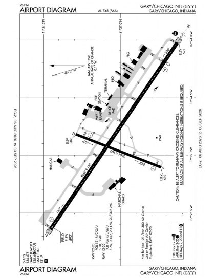
20 current FAA charts for Gary/Chicago Intl, including 8 instrument approachs, 5 departure procedures, 4 arrival procedures, 1 airport diagram. All are free to download as PDFs from this page, from the 1 October 2026 cycle.
Ground 121.9; ATIS 134.575; CTAF 125.6. Full civil VHF list, with sector notes, is in the frequencies table on this page — from the FAA NASR subscription.
Gary/Chicago Intl has 2 runways. The longest is 12/30 at 8,859 ft by 150 ft, concrete. Full runway dimensions, lighting and approach aids are listed on this page.
Yes — 2 ILS procedures are published. In total KGYY has 8 published instrument approaches, of which 6 are RNAV (GPS).
The official FAA airport diagram for Gary/Chicago Intl is free to download at the top of this page. It shows runways, taxiways, ramp layout and hold-short positions, and is reissued every 28 days.
Yes. Gary/Chicago Intl has an operating control tower, within Chicago Center's airspace. Tower, ground and clearance frequencies are listed on this page.
They are from the FAA cycle effective 1 October 2026, which is superseded on 29 October 2026. We publish each new cycle on its effective date. They are for flight simulation and reference only — not for real-world navigation.

Flying into KGYY? PRO members take all 20 charts as one ZIP instead of 20 separate downloads, at full line speed with no cap — plus every chart family archive and all 24,000+ add-ons in the library.
Go PRO
Not for navigation. For flight simulation and reference use only. Procedures are superseded on a 28-day cycle — obtain current official charts from the FAA for real-world flight.
FAA public-domain products, mirrored unmodified. Fly Away Simulation is not affiliated with or endorsed by the FAA. Chart licensing and terms.

