Page 19
Searches the whole library — filter by sim & category on the results page
Version 2 introduces an ILS-enabled layout for runway 27, offering a refined approach context for a high-elevation setting and precise alignment cues. Elevation sits calmly at 11,710 ft, underscori…
 China
China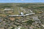
Located in southern Germany near Bodensee, EDNY Friedrichshafen gains realism through standard objects populating the surrounding area with buildings. The project, by Nichael Spengler, relies on Ai…
 Germany
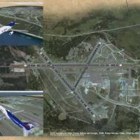
Punta Arenas, Chile's SCCI hosts an upgrade to Aeropuerto Presidente Ibáñez del Campo that refines the layout using satellite coordinates, by Orlando Veas. The visuals switch to day/night imagery, …
 Chile
Chile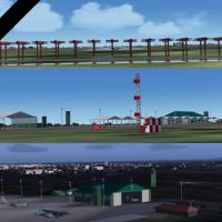
Gustavo Luna models v1.5 for Boa Vista International Airport in Brazil, identified by the SBBV registration, and distributes the work as freeware linked to the SBBV - Boa Vista folder, replacing an…
 Brazil
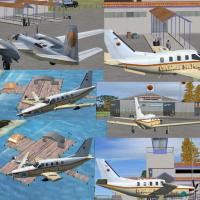
By Chris Carel, this Caribbean seaplane compilation covers Grand Cayman, Jamaica, Mexico, Central America, Curacao, Bonaire and La Orchila, and requires CSPTF.ZIP with Florida Operations installed.…
 Global (World)
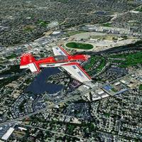
BlueSkyScenery delivers photoreal Idaho coverage spanning much of the state, including Craters of the Moon National Monument and Boise KBOI. A very large file download accompanies this offering, an…
 United States of America
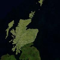
Anthony Dyer creates version 2 landclass data for Scotland, spanning the Highland and Grampian regions and the Hebrides, Orkneys and Shetland Islands, derived by hand from background satellite phot…
 United Kingdom
Freeware animation uses whale models and, through the SimConnect SDK, traces a route from a point off the coast of Nova Scotia near Halifax to a location slightly south, then returns along the same…
 Canada
Campo de Marte, SBMT, near Sao Paulo, receives a revised runway and taxiway layout with updated markings and expanded parking positions. Ren Scen is the credited creator, and the update uses BGL-fo…
Brazil
Valladier redesigns Tobago’s airfield area, centering A.N.R. Robinson International Airport (formerly Crown Point) and integrating Caribbean meshes at LOD 10 via MESHANTILLES.ZIP. TOBAGOV2.ZIP resi…
 Trinidad and Tobago
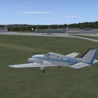
In Saarbruecken, Germany, Ensheim Airport (EDDR) uses standard objects to create a more realistic airfield layout and its surroundings, optimized for a basic visual setup and for use with the Germa…
Germany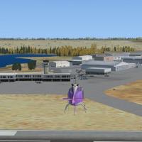
In Yellowknife, the airport carries IATA YZF and ICAO CYZF, sits in the Northwest Territories as part of the National Airports System, and the regional government operates it; it hosts regular pass…
Canada
By Roger Leupold this Gibraltar-area airport rendition requires Rwy12 object libraries and uses four files RW12L112.ZIP, RW12L212.ZIP, RW12L312.ZIP, and RW12PG12.ZIP for full placement; it remains …
 Gibraltar
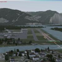
By JD Starseed, this fictional upgrade adds an ILS for runway 08 along with new parking and terminals at Juneau International Airport. The BGL files are contained in JUNEAUFIX_JD.ZIP and distribute…
United States of America
By Tom Stovall, a completely new Iwo Jima landclass and terrain integrates aircraft such as the P-51D, P-61 Black Widow, B-29, B-25, PBY, and C-47, with that variant offered in authentic colors and…
 Japan
JapanBy Steve Morrell, the LEMH site on Menorca in Islas Baleares, Spain, uses only default library objects to realize a layout for the island's airfield. The approach remains grounded in standard compo…
 Spain
Spain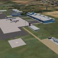
By Gustavo Luna, this Porto Velho Int'l Airport addon recreates the real layout with accurately placed taxiway signs, runway markings, and apron areas, while handcrafted buildings convey architectu…
Brazil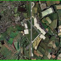
Updated Leeds Bradford layout undertakes a comprehensive redraw of aprons and parking, adds a fuel ramp, moves helipads to correct positions, and refurbishes taxiways to better match Horizon VFR vi…
United KingdomVictor Nauta develops an add-on for the Bergamo area airport known as LIME, refining gates and stands and replacing taxiway layouts with a consistent, corrected arrangement and placing custom airsi…
 Italy
Italy
An improvement for Detroit area airport at KDTW, produced by Southwest Virtual Airlines, adds moving jetways and corrected airline and AI parking, created by Rob Touchtone, known as SWVA1369. Gates…
United States of America