Page 4
Searches the whole library — filter by sim & category on the results page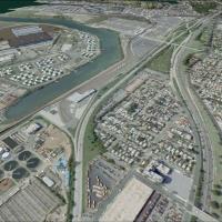
Photoreal redesign of KJFK uses ADE v01.50.11 and SBuilderX to add the American Airlines and JetBlue terminals, parking structures, warehouses, and extra gates, with runways and aprons aligned to s…
 United States of America
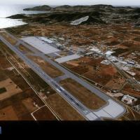
Sierra.Foxtrot-Design identifies LEIB_Ibiza_X as the SFD_LEIB_Ibiza_X directory, designed for integration within an Addon Scenery structure and containing the necessary components. Users place the …
 Spain
Spain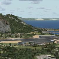
By Harry Patten, this edition places a road running through the runway with stopped traffic and adds a new terminal building, capturing a distinctive airfield layout that highlights ground movement…
 Gibraltar
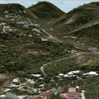
St Barthelemy island’s TFFJ aerodrome includes a slope runway, while the ASTER-based mesh in LOD11 pairs with a new waterclass. A photoreal basemap uses an IGN air photograph AWL319060 to shape the…
 Saint Barthélemy
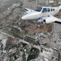
Malta coverage spans the entire island, delivering 1.5 GB of data at roughly 0.5-meter-per-pixel resolution to detail key landmarks such as Valletta. It remains compatible with add-on tools like FT…
 Malta
Malta
The LIMC project by Italian Scenery Design, credited to P Nigel Grant, adapts ISD’s Milan Malpensa to run on a newer platform. The limc_FSX patch provides files and guidance to convert the ISD cont…
 Italy
Italy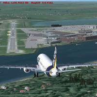
Michael Spengler creates two versions for EDHI Finkenwerder in Hamburg, Germany, using standard and freeware objects. UFC 4-211 hangars appear in blue-and-gold and Air Force Gray with Blue Accent s…
 Germany
BlueSkyScenery delivers photoreal coverage across the state of Washington, adding over 31.62 GB of detail with 1m/pixel imagery and a 10m elevation mesh that align features with real-world geograph…
United States of America
German airfield at EDDM gains an update through three BGL files that refine the airfield layout. The set includes EDDM_CVX_2.bgl for boundaries and landclass, EDDM_AD_2_01.bgl for design, and EDDM_…
Germany
By Harry Patten, London City Airport presents animated people and a car park featuring 3D cars, while gates align to real-life positions and static aircraft carry real airline markings. The layout …
 United Kingdom
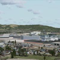
Two BGL variants exist for KSFO, KSFO_ADE_RS.BGL and KSFO_ADE_CW_RS.BGL. The CW_RS version activates crosswind runways and is paired with assigned parking plus support vehicle roads and extra fuel …
United States of America
ADE v1.37 powers the default airport variant, enabling three runways for takeoff and landing, with two BGL options: EBBR_ADE_CW_RS.BGL activates crosswind runways, while EBBR_ADE_RS.BGL remains wit…
 Belgium
By Stefan Liebe, this Amsterdam Schiphol arrangement updates taxiways and naming conventions as of January 2013 and introduces jetway functionality. The changes reside in the EHAM_V1 folder, and po…
 Netherlands
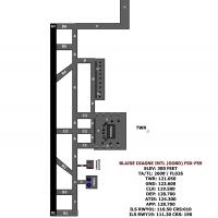
Version 2 for the GOBD facility in Senegal delivers a complete redesign of taxiways and aprons, adds the SSLI fire station building, airport parking, trees, and vehicle parking to reflect the finis…
 Senegal
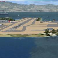
Gibraltar LXGB receives an upgrade that adds ILS approaches to runways 09 and 27, along with terminals, jetways, airport vehicles, and ships in the harbor plus enhanced navaids. Created by JD Stars…
Gibraltar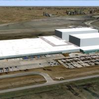
The Texas facility sits 14 miles north of Fort Worth, near Dallas/Fort Worth International, handling general aviation, corporate jets, cargo, and military traffic. It hosts American Airlines mainte…
United States of America
LSZH in Switzerland appears in the V2 edition with a frame rate friendly layout. Terminals A, B and E gain gate-number signs and ground-painted taxiway markers for clearer orientation, while the up…
 Switzerland
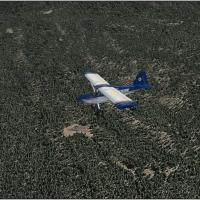
Conifer, seasonal, and tropical forest imagery are included, with global coverage and a shift from 1 meter to 30 centimeters in resolution. Only summer imagery is available, and the archive include…
 Global (World)
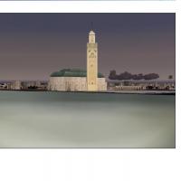
Version I by Toni Agramont adapts the Moroccan and Sahara region across Nouadhibou in Mauritania to Cebta in the north and Oujda in the east near Algery. It includes 36 airports that are totally re…
 Morocco
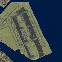
Ray Smith provides two RJTT variants, RJTT_ADE_CW_RS.BGL and RJTT_ADE_RS.BGL, enabling a crosswind activation approach or preserving two parallel runways for arrivals and departures. The crosswind …
 Japan
Japan