STUART, FL · 12 FAA charts · cycle 1 Oct 2026
2 published instrument approaches: 2 RNAV (GPS), serving 2 runway ends.
| Chart | Amendment | ||
|---|---|---|---|
| RNAV (GPS) RWY 12 | 2A | ||
| RNAV (GPS) RWY 30 | 2 |
| Chart | Amendment | ||
|---|---|---|---|
| SNDLR THREE (RNAV) | — | ||
| SNDLR THREE (RNAV), CONT.1 | — |
| Chart | Amendment | ||
|---|---|---|---|
| TTYLR FIVE | — | ||
| VUUDU TWO (RNAV) | — | ||
| VUUDU TWO (RNAV), CONT.1 | — | ||
| VUUDU TWO (RNAV), CONT.2 | — |
| Chart | Amendment | ||
|---|---|---|---|
| TAKEOFF MINIMUMS | — | ||
| ALTERNATE MINIMUMS | — |
Minimums pages cover a whole volume, so the same document is shared by every airport in it.
| Chart | Amendment | ||
|---|---|---|---|
| HOT SPOT | — |
From the FAA NASR 28-day subscription, cycle 1 Oct 2026.
| Service | Frequency | Call sign |
|---|---|---|
| CTAF | 126.6 | |
| Ground | 121.7 | Stuart |
| Clearance delivery | 121.025 | Stuart |
| ATIS | 134.475 | Stuart |
| Approach | 132.8South | Stuart |
| Emergency | 121.5 | Stuart |
Civil VHF frequencies from the FAA NASR 28-day subscription. Discrete sector and military frequencies are not listed.
| Runway | Length | Width | Surface | Lighting |
|---|---|---|---|---|
| 12/30 | 5,828 ft | 100 ft | Asphalt Good | Medium intensity |
| 12 110°T | PAPI (4-box) 3° · displaced threshold 460 ft | |||
| 30 290°T | PAPI (4-box) 3° | |||
| 16/34 | 5,000 ft | 100 ft | Asphalt Good | |
| 16 154°T | displaced threshold 336 ft | |||
| 34 334°T | displaced threshold 900 ft | |||
| 07/25 | 4,653 ft | 100 ft | Asphalt Fair | Medium intensity |
| 07 68°T | PAPI (4-box) 3° | |||
| 25 248°T | PAPI (4-box) 3° | |||
Runway and approach-aid data from the FAA NASR 28-day subscription.
27.1816990, -80.2212930
16 ft1 nm SEPaste the coordinates into a simulator’s world map to drop straight onto the field.
Published verbatim from the FAA NASR subscription. Abbreviations are the FAA's own.
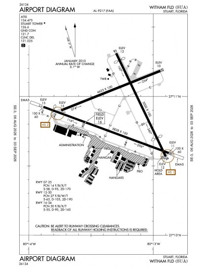
Witham Field has three runways, yet its two published approaches serve only two of the six runway ends. Both are RNAV (GPS), so the instrument arrival set is narrow in both coverage and procedure type; the remaining four ends have no published approach this cycle. Runway lengths range from 4,653 ft to 5,828 ft, making the longest alignment 1,175 ft longer than the shortest and materially changing the available length by alignment.
William P Gwinn has comparable chart coverage, while North Palm Beach County General Aviation is somewhat broader. Treasure Coast International and Vero Beach Regional have thinner sets, and President Donald J Trump International has substantially broader coverage. The Miami Sectional and Caribbean 1 VFR chart provide wider VFR context beyond the terminal procedures.
| ID | Airport | City | Distance | Charts |
|---|---|---|---|---|
| 06FA | William P Gwinn | JUPITER, FL | 17 nm S | 12 |
| F45 | North Palm Beach County General Aviation | WEST PALM BEACH, FL | 20 nm S | 16 |
| KFPR | Treasure Coast Intl | FORT PIERCE, FL | 21 nm NW | 9 |
| KVRB | Vero Beach Rgnl | VERO BEACH, FL | 30 nm N | 9 |
| KDJT | President Donald J Trump Intl | WEST PALM BEACH, FL | 31 nm S | 42 |
| KOBE | Okeechobee County | OKEECHOBEE, FL | 34 nm W | 5 |
| KPHK | Palm Beach County Glades | PAHOKEE, FL | 35 nm SW | 3 |
| KLNA | Palm Beach County Park | WEST PALM BEACH, FL | 36 nm S | 10 |
12 current FAA charts for Witham Fld, including 2 instrument approachs, 2 departure procedures, 4 arrival procedures, 1 airport diagram. All are free to download as PDFs from this page, from the 1 October 2026 cycle.
Ground 121.7; ATIS 134.475; CTAF 126.6; Clearance delivery 121.025. Full civil VHF list, with sector notes, is in the frequencies table on this page — from the FAA NASR subscription.
Witham Fld has 3 runways. The longest is 12/30 at 5,828 ft by 100 ft, asphalt. Full runway dimensions, lighting and approach aids are listed on this page.
No ILS is published. In total KSUA has 2 published instrument approaches, of which 2 are RNAV (GPS).
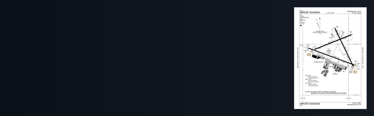
The official FAA airport diagram for Witham Fld is free to download at the top of this page. It shows runways, taxiways, ramp layout and hold-short positions, and is reissued every 28 days.
Yes. Witham Fld has an operating control tower, within Miami Center's airspace. Tower, ground and clearance frequencies are listed on this page.
They are from the FAA cycle effective 1 October 2026, which is superseded on 29 October 2026. We publish each new cycle on its effective date. They are for flight simulation and reference only — not for real-world navigation.

Flying into KSUA? PRO members take all 12 charts as one ZIP instead of 12 separate downloads, at full line speed with no cap — plus every chart family archive and all 24,000+ add-ons in the library.
Go PRO
Not for navigation. For flight simulation and reference use only. Procedures are superseded on a 28-day cycle — obtain current official charts from the FAA for real-world flight.
FAA public-domain products, mirrored unmodified. Fly Away Simulation is not affiliated with or endorsed by the FAA. Chart licensing and terms.

