COCOA BEACH, FL · 1 FAA charts · cycle 1 Oct 2026
| Chart | Amendment | ||
|---|---|---|---|
| BITHO SEVEN | — |
From the FAA NASR 28-day subscription, cycle 1 Oct 2026.
| Service | Frequency | Call sign |
|---|---|---|
| Tower | 118.625126.2143.15 | Cape |
| Approach | 134.95 | Cape |
Civil VHF frequencies from the FAA NASR 28-day subscription. Discrete sector and military frequencies are not listed.
| Runway | Length | Width | Surface | Lighting |
|---|---|---|---|---|
| 13/31 | 9,999 ft | 200 ft | Asphalt | High intensity |
| 13 128°T | PAPI (4-box) 3° | |||
| 31 308°T | PAPI (4-box) 3° · SALS | |||
Runway and approach-aid data from the FAA NASR 28-day subscription.
28.4675860, -80.5666170
9 ft7 nm NEPaste the coordinates into a simulator’s world map to drop straight onto the field.
Published verbatim from the FAA NASR subscription. Abbreviations are the FAA's own.
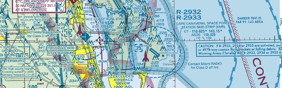
Cape Canaveral Space Force Station Skid Strip pairs its 9,999 ft Runway 13/31 with just one published chart, in the STR category. There are no published approach or departure charts for either runway end in this cycle, and no airport diagram. The runway provides considerable length, but its single alignment means there is no alternative runway orientation.
Chart coverage is markedly broader at Space Coast Regional, with 14 charts, and Patrick Space Force Base, with 11. Merritt Island and the Space Florida Launch and Landing Facility occupy the middle ground, while Arthur Dunn Air Park’s two-chart set is closest in scale to XMR’s sparse coverage. The Jacksonville and Miami sectionals add wider VFR geographic and airspace context absent from the lone terminal chart.
| ID | Airport | City | Distance | Charts |
|---|---|---|---|---|
| KCOI | Merritt Island | MERRITT ISLAND, FL | 10 nm SW | 6 |
| KTTS | Space Florida Launch And Landing Facility | TITUSVILLE, FL | 11 nm NW | 5 |
| KTIX | Space Coast Rgnl | TITUSVILLE, FL | 13 nm W | 14 |
| KCOF | Patrick Space Force Base | COCOA BEACH, FL | 14 nm S | 11 |
| X21 | Arthur Dunn Air Park | TITUSVILLE, FL | 17 nm NW | 2 |
| KMLB | Melbourne Orlando Intl | MELBOURNE, FL | 22 nm S | 16 |
| X59 | Valkaria | VALKARIA, FL | 30 nm S | 4 |
| X50 | Massey Ranch Airpark | NEW SMYRNA BEACH, FL | 36 nm NW | 5 |
1 current FAA charts for Cape Canaveral Space Force Station Skid Strip, including 1 arrival procedure. All are free to download as PDFs from this page, from the 1 October 2026 cycle.
Tower 118.625, 126.2, 143.15. Full civil VHF list, with sector notes, is in the frequencies table on this page — from the FAA NASR subscription.
Cape Canaveral Space Force Station Skid Strip has 1 runway. The longest is 13/31 at 9,999 ft by 200 ft, asphalt. Full runway dimensions, lighting and approach aids are listed on this page.
Yes. Cape Canaveral Space Force Station Skid Strip has an operating control tower, within Jacksonville Center's airspace. Tower, ground and clearance frequencies are listed on this page.
They are from the FAA cycle effective 1 October 2026, which is superseded on 29 October 2026. We publish each new cycle on its effective date. They are for flight simulation and reference only — not for real-world navigation.

Flying into KXMR? PRO members take all 1 charts as one ZIP instead of 1 separate downloads, at full line speed with no cap — plus every chart family archive and all 24,000+ add-ons in the library.
Go PRO
Not for navigation. For flight simulation and reference use only. Procedures are superseded on a 28-day cycle — obtain current official charts from the FAA for real-world flight.
FAA public-domain products, mirrored unmodified. Fly Away Simulation is not affiliated with or endorsed by the FAA. Chart licensing and terms.

