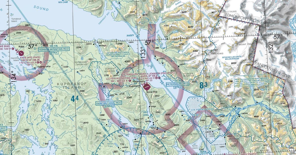
Official FAA digital chart — free GeoTIFF and PDF download
| Format | What you get | Size | |
|---|---|---|---|
| GeoTIFF | Georeferenced raster at 300 dpi, with world file and FGDC metadata | 62.2 MB | Download |
| Print-ready chart, no georeferencing | 126.5 MB | Download |
Not for navigation. For flight simulation and reference use only. Check the effective dates above, and obtain official charts from the FAA for real-world flight.

These are big files. This chart alone is 126.5 MB. Guest downloads are rate limited; PRO members get full-speed, unthrottled downloads across every chart and all 24,000+ add-ons in the library.
Go PROJuneau, Glacier Bay and the Gulf of Alaska coast anchor a sheet dominated by water, ice and abrupt mountain terrain. It covers much of Alaska’s southeastern panhandle, including the northern Alexander Archipelago, deeply cut channels and fjords, and the coast towards Yakutat. Inland, coverage reaches across the Coast Mountains into parts of north-western British Columbia and south-western Yukon.
The landscape gives the chart a strongly coastal character: island chains and sheltered waterways contrast with exposed Gulf shores, while extensive icefields and glaciers occupy the higher country. Routes crossing the region can move quickly between maritime and mountainous settings.
The Ketchikan sectional continues coverage to the south along the panhandle. To the west, the Seward and Anchorage sheets carry routes onwards around the northern Gulf of Alaska and into south-central Alaska. These joins matter particularly for longer coastal journeys, where the Juneau sheet forms the central link between the narrow south-eastern corridor and the broader Gulf coast.
| ID | Airport | City | Elev | Rwys | Longest |
|---|---|---|---|---|---|
| PAJN JNU | Juneau Intl | JUNEAU, AK | 25 ft | 2 | 8,857 ft |
| PAYA YAK | Yakutat | YAKUTAT, AK | 39 ft | 2 | 7,732 ft |
| PASI SIT | Sitka Rocky Gutierrez | SITKA, AK | 26 ft | 1 | 7,200 ft |
| PAGS GST | Gustavus | GUSTAVUS, AK | 36 ft | 2 | 6,720 ft |
| PAPG PSG | Petersburg James A Johnson | PETERSBURG, AK | 113 ft | 1 | 6,400 ft |
| CYDL | Dease Lake | DEASE LAKE | 2,634 ft | 1 | 6,003 ft |
| PAWG WRG | Wrangell | WRANGELL, AK | 44 ft | 1 | 6,000 ft |
| PAKW AKW | Klawock | KLAWOCK, AK | 79 ft | 1 | 5,000 ft |
| CYZW | Teslin | TESLIN | 2,313 ft | 1 | 4,993 ft |
| PAHN HNS | Haines | HAINES, AK | 29 ft | 2 | 4,000 ft |
| PAFE AFE | Kake | KAKE, AK | 171 ft | 1 | 4,000 ft |
| CYSQ | Atlin | ATLIN | 2,351 ft | 1 | 3,950 ft |
| CZST | Stewart | STEWART | 24 ft | 1 | 3,900 ft |
| 3AK | Dry Bay | YAKUTAT, AK | 33 ft | 1 | 3,600 ft |
| PAGY SGY | Skagway | SKAGWAY, AK | 44 ft | 1 | 3,550 ft |
| PAOH HNH | Hoonah | HOONAH, AK | 21 ft | 1 | 3,367 ft |
| CBS4 | Mule Creek | MULE CREEK | 2,900 ft | 1 | 2,460 ft |
| A68 | Situk | YAKUTAT, AK | 60 ft | 1 | 2,150 ft |
| A67 | Harlequin Lake | YAKUTAT, AK | 113 ft | 1 | 2,100 ft |
| A69 | Tanis Mesa | YAKUTAT, AK | 183 ft | 1 | 1,900 ft |
| A57 | Alsek River | YAKUTAT, AK | 53 ft | 1 | 1,860 ft |
| AK76 | East Alsek River | YAKUTAT, AK | 39 ft | 1 | 1,500 ft |
22 public-use airports within this chart's coverage, ordered by runway length. A further 4 private and restricted landing facilities are not listed. Source: FAA NASR 28-day subscription.
Approach plates and airport diagrams for every airport in the states this sheet covers:
It spans 55.4°N to 60.3°N and 142.4°W to 129.7°W. Airports on the sheet fall within Alaska. The full list of public-use airports within its coverage is on this page.
Take the GeoTIFF if you are loading the chart into moving-map software or a flight planner — it is georeferenced, so the software can place it correctly on a map, and it ships with a world file and FGDC metadata at 300 dpi (62.2 MB). Take the PDF to print it or read it on a second screen (126.5 MB); it is the same chart without georeferencing.
This is the FAA edition effective 3 September 2026, which is superseded on 29 October 2026. Visual charts are reissued every 56 days and we publish each new edition on the day it takes effect. It is for flight simulation and reference only — not for real-world navigation.
Ketchikan to the south, Seward to the west and Anchorage to the west. Each is linked from this page, so a route running off one edge can be continued on the next sheet.
Yes, with no account required. FAA charts are United States Government works and are not subject to copyright protection in the US under 17 U.S.C. § 105. Guest downloads are speed-capped, so a sheet this size takes a while; PRO members download at full line speed and can take the whole family as one archive.

FAA public-domain products, mirrored unmodified. Fly Away Simulation is not affiliated with or endorsed by the FAA. Chart licensing and terms.

