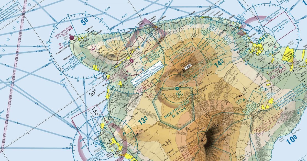
Official FAA digital chart — free GeoTIFF and PDF download
| Format | What you get | Size | |
|---|---|---|---|
| GeoTIFF | Georeferenced raster at 300 dpi, with world file and FGDC metadata | 26.0 MB | Download |
| Print-ready chart, no georeferencing | 54.9 MB | Download |
Not for navigation. For flight simulation and reference use only. Check the effective dates above, and obtain official charts from the FAA for real-world flight.

These are big files. This chart alone is 54.9 MB. Guest downloads are rate limited; PRO members get full-speed, unthrottled downloads across every chart and all 24,000+ add-ons in the library.
Go PROFrom Kaua‘i and Ni‘ihau in the north-west to the island of Hawai‘i in the south-east, this sheet covers the full main Hawaiian archipelago and a broad expanse of the surrounding Pacific. O‘ahu, Moloka‘i, Lāna‘i, Maui and Kaho‘olawe sit within the same continuous view, together with the channels separating them.
The chart’s geography is defined by contrast: compact volcanic islands rise from otherwise open ocean, with rugged mountain interiors, deeply cut valleys and irregular coastlines. Inter-island flying therefore alternates between prominent landforms and stretches where the sea dominates the view. The coverage also extends well beyond the islands to the north, south and east, giving useful context for routes approaching or leaving the chain.
Unlike continental sectional sheets, it has no adjoining chart of the same type. The principal Hawaiian Islands and their surrounding waters are presented as a self-contained regional sheet rather than one panel in a larger tiled sequence.
| ID | Airport | City | Elev | Rwys | Longest |
|---|---|---|---|---|---|
| PHNL HNL | Daniel K Inouye Intl | HONOLULU, HI | 13 ft | 6 | 12,360 ft |
| PHKO KOA | Ellison Onizuka Kona Intl At Keahole | KAILUA-KONA, HI | 50 ft | 1 | 11,000 ft |
| PHTO ITO | Hilo Intl | HILO, HI | 37 ft | 2 | 9,803 ft |
| PHDH HDH | Kawaihapai Airfield | MOKULEIA, HI | 14 ft | 1 | 9,007 ft |
| PHJR JRF | Kalaeloa (John Rodgers Fld) | KAPOLEI, HI | 32 ft | 3 | 8,365 ft |
| PHOG OGG | Kahului | KAHULUI, HI | 55 ft | 3 | 6,998 ft |
| PHLI LIH | Lihue | LIHUE, HI | 152 ft | 5 | 6,500 ft |
| PHMU MUE | Waimea-Kohala | KAMUELA, HI | 2,671 ft | 1 | 5,197 ft |
| PHNY LNY | Lanai | LANAI CITY, HI | 1,308 ft | 1 | 5,001 ft |
| PHMK MKK | Molokai | KAUNAKAKAI, HI | 453 ft | 2 | 4,494 ft |
| PHUP UPP | Upolu | HAWI, HI | 96 ft | 1 | 3,800 ft |
| PHHN HNM | Hana | HANA, HI | 77 ft | 1 | 3,606 ft |
| PHLU LUP | Kalaupapa | KALAUPAPA, HI | 23 ft | 1 | 2,700 ft |
| PHPA PAK | Port Allen | HANAPEPE, HI | 24 ft | 1 | 2,450 ft |
14 public-use airports within this chart's coverage, ordered by runway length. A further 10 private and restricted landing facilities are not listed. Source: FAA NASR 28-day subscription.
Approach plates and airport diagrams for every airport in the states this sheet covers:
It spans 17.7°N to 24.0°N and 161.8°W to 153.4°W. Airports on the sheet fall within Hawaii. The full list of public-use airports within its coverage is on this page.
Take the GeoTIFF if you are loading the chart into moving-map software or a flight planner — it is georeferenced, so the software can place it correctly on a map, and it ships with a world file and FGDC metadata at 300 dpi (26.0 MB). Take the PDF to print it or read it on a second screen (54.9 MB); it is the same chart without georeferencing.
This is the FAA edition effective 3 September 2026, which is superseded on 29 October 2026. Visual charts are reissued every 56 days and we publish each new edition on the day it takes effect. It is for flight simulation and reference only — not for real-world navigation.
Yes, with no account required. FAA charts are United States Government works and are not subject to copyright protection in the US under 17 U.S.C. § 105. Guest downloads are speed-capped, so a sheet this size takes a while; PRO members download at full line speed and can take the whole family as one archive.

FAA public-domain products, mirrored unmodified. Fly Away Simulation is not affiliated with or endorsed by the FAA. Chart licensing and terms.

