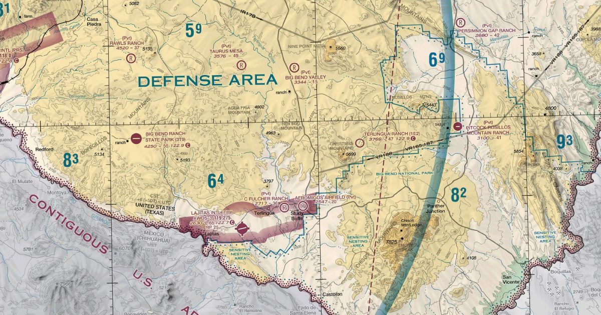
Official FAA digital chart — free GeoTIFF and PDF download
| Format | What you get | Size | |
|---|---|---|---|
| GeoTIFF | Georeferenced raster at 300 dpi, with world file and FGDC metadata | 54.3 MB | Download |
| Print-ready chart, no georeferencing | 117.7 MB | Download |
Not for navigation. For flight simulation and reference use only. Check the effective dates above, and obtain official charts from the FAA for real-world flight.

These are big files. This chart alone is 117.7 MB. Guest downloads are rate limited; PRO members get full-speed, unthrottled downloads across every chart and all 24,000+ add-ons in the library.
Go PROEl Paso anchors a sheet stretching across southern New Mexico, far western Texas and a broad part of northern Mexico. The Chihuahuan Desert defines much of the landscape, broken by the Guadalupe and Davis mountains, the ranges around Big Bend and isolated ridges rising from open basins. The Rio Grande forms the central geographical thread through El Paso and the border country before turning through the rugged south-west Texas interior. Farther east, the terrain opens towards the western edge of the Permian Basin and the plains beyond.
Routes continuing north move onto the Albuquerque chart, while north-westerly coverage connects with Phoenix. San Antonio adjoins directly to the east, with Dallas–Fort Worth taking over towards the north-east and Brownsville towards the south-east. Together, those joins matter for longer flights linking the desert Southwest with central and southern Texas: this sheet covers the mountainous transition, while the neighbouring charts carry the route into broader plains and Gulf-facing country.
| ID | Airport | City | Elev | Rwys | Longest |
|---|---|---|---|---|---|
| KELP ELP | El Paso Intl | EL PASO, TX | 3,961 ft | 3 | 12,020 ft |
| KDNA DNA | Dona Ana County Intl Jetport | SANTA TERESA, NM | 4,112 ft | 1 | 9,550 ft |
| KDMN DMN | Deming Muni | DEMING, NM | 4,314 ft | 2 | 8,018 ft |
| KFST FST | Fort Stockton-Pecos County | FORT STOCKTON, TX | 3,011 ft | 5 | 7,508 ft |
| T89 | Lajitas Intl | LAJITAS, TX | 2,630 ft | 1 | 6,501 ft |
| KDUG DUG | Bisbee Douglas Intl | DOUGLAS BISBEE, AZ | 4,150 ft | 2 | 6,430 ft |
| KPEQ PEQ | Pecos Muni | PECOS, TX | 2,613 ft | 2 | 6,236 ft |
| KMRF MRF | Marfa Muni | MARFA, TX | 4,848 ft | 3 | 6,203 ft |
| KVHN VHN | Culberson County | VAN HORN, TX | 3,956 ft | 2 | 6,005 ft |
| E38 | Alpine-Casparis Muni | ALPINE, TX | 4,514 ft | 2 | 6,002 ft |
| KDGL DGL | Douglas Muni | DOUGLAS, AZ | 4,173 ft | 2 | 5,760 ft |
| P03 | Cochise College | DOUGLAS, AZ | 4,146 ft | 1 | 5,551 ft |
| 3T9 | Big Bend Ranch State Park | PRESIDIO, TX | 4,250 ft | 1 | 5,500 ft |
| KPRS PRS | Presidio Lely Intl | PRESIDIO, TX | 2,938 ft | 1 | 5,200 ft |
| KINK INK | Winkler County | WINK, TX | 2,821 ft | 2 | 5,003 ft |
| E26 | Lea County/Jal | JAL, NM | 3,118 ft | 2 | 4,704 ft |
| 1E2 | Terlingua Ranch | ALPINE, TX | 3,769 ft | 1 | 4,700 ft |
| 2E5 | Dell City Muni | DELL CITY, TX | 3,703 ft | 1 | 4,685 ft |
| E01 | Roy Hurd Meml | MONAHANS, TX | 2,614 ft | 2 | 4,268 ft |
| E35 | Fabens | FABENS, TX | 3,680 ft | 1 | 4,197 ft |
20 public-use airports within this chart's coverage, ordered by runway length. A further 47 private and restricted landing facilities are not listed. Source: FAA NASR 28-day subscription.
Approach plates and airport diagrams for every airport in the states this sheet covers:
It spans 27.5°N to 32.3°N and 109.9°W to 102.4°W. Airports on the sheet fall within Arizona, New Mexico and Texas. The full list of public-use airports within its coverage is on this page.
Take the GeoTIFF if you are loading the chart into moving-map software or a flight planner — it is georeferenced, so the software can place it correctly on a map, and it ships with a world file and FGDC metadata at 300 dpi (54.3 MB). Take the PDF to print it or read it on a second screen (117.7 MB); it is the same chart without georeferencing.
This is the FAA edition effective 3 September 2026, which is superseded on 29 October 2026. Visual charts are reissued every 56 days and we publish each new edition on the day it takes effect. It is for flight simulation and reference only — not for real-world navigation.
San Antonio to the east, Albuquerque to the north, Phoenix to the north-west, Brownsville to the south-east and Dallas-Ft Worth to the north-east. Each is linked from this page, so a route running off one edge can be continued on the next sheet.
Yes, with no account required. FAA charts are United States Government works and are not subject to copyright protection in the US under 17 U.S.C. § 105. Guest downloads are speed-capped, so a sheet this size takes a while; PRO members download at full line speed and can take the whole family as one archive.

FAA public-domain products, mirrored unmodified. Fly Away Simulation is not affiliated with or endorsed by the FAA. Chart licensing and terms.

