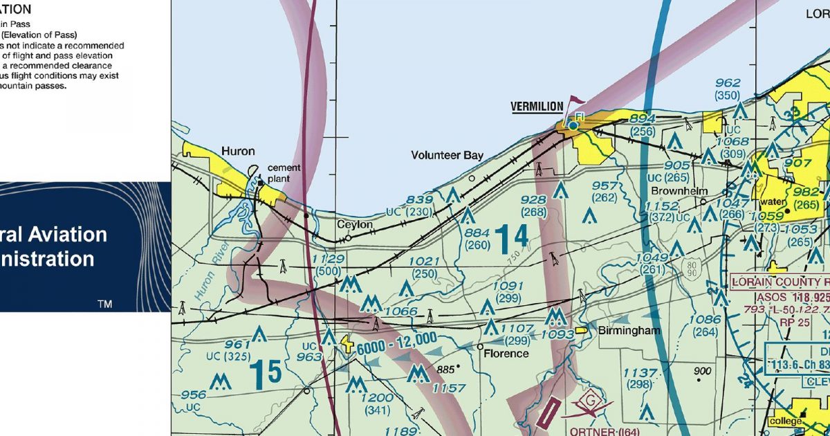
Official FAA digital chart — free GeoTIFF and PDF download
| Format | What you get | Size | |
|---|---|---|---|
| GeoTIFF | Georeferenced raster at 300 dpi, with world file and FGDC metadata | 11.7 MB | Download |
| Print-ready chart, no georeferencing | 23.6 MB | Download |
Not for navigation. For flight simulation and reference use only. Check the effective dates above, and obtain official charts from the FAA for real-world flight.

These are big files. This chart alone is 23.6 MB. Guest downloads are rate limited; PRO members get full-speed, unthrottled downloads across every chart and all 24,000+ add-ons in the library.
Go PROCleveland’s Lake Erie shoreline anchors a sheet extending west towards the lake’s island-dotted western basin and east towards the Pennsylvania border. Inland coverage reaches across the Akron area and towards Canton, Youngstown and the surrounding north-east Ohio countryside. The flying environment shifts from the level lakeshore and dense Cleveland conurbation to rolling inland terrain, with increasingly broken ground towards western Pennsylvania.
The chart’s footprint is approximately 111 nautical miles wide by 72 nautical miles tall, making it suited to routes centred on Cleveland and the southern Lake Erie corridor. North-westbound journeys can continue onto the adjoining Detroit Terminal Area Chart, while the Pittsburgh sheet provides the corresponding continuation to the south-east. Those joins are particularly relevant for routes following the lake before turning into south-east Michigan, or crossing the Ohio–Pennsylvania interior beyond the Cleveland area.
| ID | Airport | City | Elev | Rwys | Longest |
|---|---|---|---|---|---|
| KCLE CLE | Cleveland-Hopkins Intl | CLEVELAND, OH | 799 ft | 3 | 9,953 ft |
| KYNG YNG | Youngstown/Warren Rgnl | YOUNGSTOWN/WARREN, OH | 1,191 ft | 3 | 9,003 ft |
| KMFD MFD | Mansfield Lahm Rgnl | MANSFIELD, OH | 1,297 ft | 2 | 9,001 ft |
| KCAK CAK | Akron-Canton Rgnl | AKRON, OH | 1,225 ft | 2 | 8,204 ft |
| KBKL BKL | Burke Lakefront | CLEVELAND, OH | 583 ft | 2 | 6,604 ft |
| KAKR AKR | Akron Fulton Intl | AKRON, OH | 1,067 ft | 1 | 6,336 ft |
| KHZY HZY | Northeast Ohio Rgnl | ASHTABULA, OH | 926 ft | 1 | 5,900 ft |
| KPCW PCW | Erie-Ottawa Intl | PORT CLINTON, OH | 590 ft | 2 | 5,646 ft |
| KCGF CGF | Cuyahoga County | CLEVELAND, OH | 876 ft | 1 | 5,502 ft |
| KBJJ BJJ | Wayne County | WOOSTER, OH | 1,135 ft | 1 | 5,190 ft |
| KLNN LNN | Lake County Exec | WILLOUGHBY, OH | 625 ft | 2 | 5,028 ft |
| KLPR LPR | Lorain County Rgnl | LORAIN/ELYRIA, OH | 793 ft | 1 | 5,002 ft |
| 5A1 | Norwalk/Huron County | NORWALK, OH | 852 ft | 1 | 4,208 ft |
| 8G1 | Willard | WILLARD, OH | 966 ft | 1 | 4,028 ft |
| 4G4 | Youngstown Elser Metro | YOUNGSTOWN, OH | 1,069 ft | 1 | 4,012 ft |
| 1G3 | Kent State University | KENT, OH | 1,134 ft | 1 | 4,000 ft |
| I64 | Ortner | WAKEMAN, OH | 848 ft | 1 | 3,800 ft |
| 1G5 | Medina Muni | MEDINA, OH | 1,189 ft | 2 | 3,556 ft |
| 3G3 | Wadsworth Muni | WADSWORTH, OH | 973 ft | 2 | 3,530 ft |
| 3G4 | Ashland County | ASHLAND, OH | 1,206 ft | 1 | 3,501 ft |
| 7G8 | Geauga County | MIDDLEFIELD, OH | 1,174 ft | 1 | 3,500 ft |
| 2D1 | Lee Fld | ALLIANCE, OH | 1,062 ft | 2 | 3,500 ft |
| KPOV POV | Portage County | RAVENNA, OH | 1,197 ft | 1 | 3,499 ft |
| 38D | Salem Airpark | SALEM, OH | 1,162 ft | 2 | 3,404 ft |
| CYPT | Pelee Island | PELEE ISLAND | 571 ft | 2 | 3,300 ft |
| 12G | Shelby Community | SHELBY, OH | 1,120 ft | 2 | 3,174 ft |
| 4G8 | Columbia | COLUMBIA STATION, OH | 810 ft | 1 | 3,152 ft |
| 04G | Lansdowne | YOUNGSTOWN, OH | 1,043 ft | 1 | 3,073 ft |
| 1G1 | Elyria | ELYRIA, OH | 757 ft | 1 | 3,053 ft |
| 41N | Braceville | NEWTON FALLS, OH | 900 ft | 1 | 3,000 ft |
| 4G3 | Miller | ALLIANCE, OH | 1,071 ft | 1 | 2,912 ft |
| 62D | Warren | WARREN, OH | 905 ft | 2 | 2,907 ft |
| 3W2 | Put In Bay | PUT IN BAY, OH | 595 ft | 1 | 2,870 ft |
| 7D8 | Gates | GARRETTSVILLE, OH | 1,104 ft | 1 | 2,800 ft |
| 3G6 | Tri-City | SEBRING, OH | 1,187 ft | 1 | 2,768 ft |
| 5D9 | Bandit Fld Airdrome | CLYDE, OH | 805 ft | 1 | 2,630 ft |
| 88D | Hinde | HURON, OH | 609 ft | 1 | 2,501 ft |
| 15G | Weltzien Skypark | WADSWORTH, OH | 1,210 ft | 1 | 2,410 ft |
| 1D4 | Mayfield | AKRON, OH | 1,100 ft | 1 | 2,315 ft |
| 89D | Kelleys Island Land Fld | KELLEYS ISLAND, OH | 598 ft | 1 | 2,202 ft |
| 2G1 | Concord Airpark | PAINESVILLE, OH | 998 ft | 1 | 2,181 ft |
| 3W9 | Middle Bass-East Point | MIDDLE BASS ISLAND, OH | 582 ft | 1 | 2,085 ft |
| 3T7 | Middle Bass Island | MIDDLE BASS ISLAND, OH | 579 ft | 1 | 1,852 ft |
| 8G8 | Koons | SALEM, OH | 1,327 ft | 1 | 1,821 ft |
| 3X5 | North Bass Island | NORTH BASS ISLAND, OH | 594 ft | 1 | 1,804 ft |
45 public-use airports within this chart's coverage, ordered by runway length. A further 66 private and restricted landing facilities are not listed. Source: FAA NASR 28-day subscription.
Approach plates and airport diagrams for every airport in the states this sheet covers:
It spans 40.8°N to 42.0°N and 83.0°W to 80.6°W. Airports on the sheet fall within Ohio. The full list of public-use airports within its coverage is on this page.
Take the GeoTIFF if you are loading the chart into moving-map software or a flight planner — it is georeferenced, so the software can place it correctly on a map, and it ships with a world file and FGDC metadata at 300 dpi (11.7 MB). Take the PDF to print it or read it on a second screen (23.6 MB); it is the same chart without georeferencing.
This is the FAA edition effective 3 September 2026, which is superseded on 29 October 2026. Visual charts are reissued every 56 days and we publish each new edition on the day it takes effect. It is for flight simulation and reference only — not for real-world navigation.
Detroit to the north-west and Pittsburgh to the south-east. Each is linked from this page, so a route running off one edge can be continued on the next sheet.
Yes, with no account required. FAA charts are United States Government works and are not subject to copyright protection in the US under 17 U.S.C. § 105. Guest downloads are speed-capped, so a sheet this size takes a while; PRO members download at full line speed and can take the whole family as one archive.

FAA public-domain products, mirrored unmodified. Fly Away Simulation is not affiliated with or endorsed by the FAA. Chart licensing and terms.

