Page 9
Searches the whole library — filter by sim & category on the results page
The gauges.h file is updated and corrected to be backwards-compatible with older code, intended for gauge developers only. It now compiles C-gauges, and credits Dai Griffiths of Dragonflight Design.
 59.45 KB
 189Apr 2013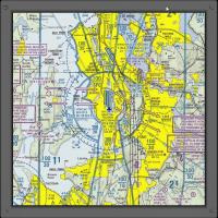
An expansion for CRGSIM-0.044 provides extensive area charts covering the United States, aligning with the CRGSIM-0.044 framework and outlining chart coverage. Compatibility requires CRGSIM-0.044, …
128.64 MB186Jun 2013 1
1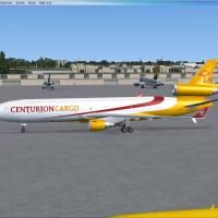 Patch
PatchUpdate covers the operator's two aircraft types, MD-11s and DC-10s, operating out of Miami International, and adds A300 flight plans for New York routes, with Joseph Calleja as author for this upda…
215.06 KB180Jun 20132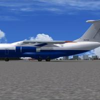
Flight plans cover Gira Globo's sole IL-76 D2-FCO, based in Luanda, and reference the aircraft's D2-FCO registration. Antoine Calleja for Globusworld authors the material, carrying the creator's na…
88.63 KB169Jun 20131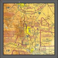
Charts covering terminal regions span Baltimore Washington, Seattle, Chicago, Houston, Los Angeles, and San Diago, with six cities also receiving VFR coverage. The distribution aligns with CRGSIM-0…
196.43 MB168Jun 20131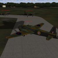
AI Wellington aircraft appear and park around the RAF Driffield airfield for users who have already installed the Wellington content. The note credits R. A. Baum for this addition, with the AI Well…
1.17 MB160Jun 2013 5/51
5/51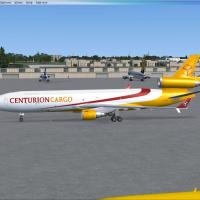
Flight plans cover the carrier's MD-11s and DC-10s operating from Miami International. New York-based A300 flight plans include Joseph Calleja as author, and an image shows a DC-10 on the ground in…
214.61 KB159Jun 20132
The default 64x64 BMP moon images are replaced with 512x512 BMPs, and the alpha channel is swapped for higher-resolution imagery, updating the moonX.bmp files. A backup of the original moonX.bmp in…
2.41 MB150Apr 2013
Spring 2011 flight plans for Tropic Air of Belize draw data from the airline’s booking site, with or without representative charter flights for their additional aircraft; the compilation is authore…
21.37 KB143Jun 2013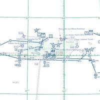
An add-on presents nine distinct low-altitude routes across Guam and Puerto Rico, with IFR, VFR, and slow-speed options for realistic training. Bill McClellan contributes the core routes, while Kar…
1.56 MB140May 20132
Marten Weber documents the Dash 8-400 flight plans for Securite Civile France, delivering creatively varied routing. Airports exclusive to the platform may appear, and users should look for missing…
16.14 KB137Jun 2013
Fictional and fully fictitious flight plans accompany four Luxair planes, authored by Dick Stellweg, spanning roughly 1970–1998, and they attach to the ancient Luxair fleet, while not reflecting re…
754.85 KB135Jun 20131
A template for creating images uses a logo and comes in Paint Shop Pro format, offering a flexible, straightforward solution for graphic work. By Andy Johnston, it carries author attribution and ce…
116.55 KB128Apr 20135/5Starting at Craig Field, this Jacksonville tour passes Mayport NAS with a carrier docked, NAS Jacksonville, downtown Jacksonville, Herlong Airport, and Cecil Field before finishing at Jacksonville …
2.35 KB123Apr 2013
Christian Lambert creates a sepia-filtered logo depiction, with the author credited, that highlights a warm, nostalgic hue for display purposes. A folder named Uires accompanies the contents and re…
12.2 MB123Apr 201313
Maximus Air Cargo operates three Ilyushin IL-76s from the United Arab Emirates. Antoine Calleja of Globusworld is credited as the author for these plans, documenting the carrier's use of this aircr…
4.01 KB116Jun 2013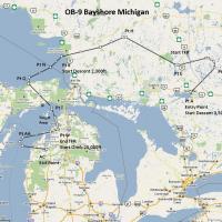
An IFR-style, high-speed, low-altitude routing traverses the OB-9 Bayshore corridor over Michigan and adjacent Ontario, emphasizing water crossings and varied terrain. The offering includes two gau…
944.04 KB114May 20131
Two A320-200CFM airframes leased from Czech Airlines Holidays operate for Iceland Express, registered OK-HCA and OK-HCB, with Reykjavik as base. Flight plans cover March 26 to May 31, 2012, are Spr…
6.16 KB110Jun 2013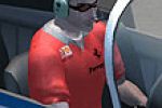
Three outfits update the SF-260 pilot, pairing Oakley tortoise shell sunglasses with a red Ferrari shirt, a brown leather jacket, or a Coogi sweater with white linen slacks. A dedicated file, named…
723.81 KB106May 2013
Two Saab 340 aircraft operated by a coast guard unit are based at Kansai airport in western Japan. By Marten Weber, a ZIP file AISF3JCG.ZIP is linked to the flight plans for these operations here.
23.75 KB104Jun 2013